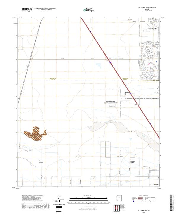
2021 Map of Gila Butte NW
USGS Topo · Published 2021About this map
The Gila River corridor defines this portion of the Gila River Indian Reservation, revealing a landscape where ancestral history meets modern suburban expansion. The Hohokam Pima National Monument encompasses the site of Snaketown, a significant archaeological area preserving the remains of a complex prehistoric agricultural society. This indigenous heritage continues through modern tribal settlements such as Sacate Village, Wet Camp Village, and Bapchule, which are situated south of the river channel. In the northeast, the map documents the dense residential growth of Chandler and the Sun Lakes community. This juxtaposition of the ancient irrigation-based landscape of the Gila Valley against the rapidly developing residential grids of southern Maricopa County illustrates the ongoing transformation of the Arizona desert.
Find a feature on this map
68 named features on this map. Tap any name to fly to it.
Don’t see what you’re looking for? This feature index may not catch every label — zoom into the map to look around manually.
Map Details
Editions of this 2021 Gila Butte NW Map
This is the sole edition of this map. No revisions or reprints were ever made.
Other maps of this area

1912 · Phoenix
USGS Topo · 1:62,500

1913 · Mesa
USGS Topo · 1:62,500

1913 · Maricopa
USGS Topo · 1:62,500

1914 · Gila Butte
USGS Topo · 1:62,500

1914 · Phoenix
USGS Topo · 1:62,500

1915 · Mesa
USGS Topo · 1:62,500

1915 · Maricopa
USGS Topo · 1:62,500

1917 · Gila Butte
USGS Topo · 1:62,500

1952 · Gila Butte SE
USGS Topo · 1:24,000

1952 · Maricopa
USGS Topo · 1:24,000