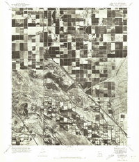
1971 Map of Gila Butte
USGS Topo · Published 1972About this map
Ocotillo and Bapchule represent the primary points of settlement in this orthophotomap of Pinal County, where agricultural grid patterns sharply meet the untamed desert floor. Captured via aerial photography in the early 1970s, the landscape is defined by the heavy contrast between irrigated fields and the natural topography of the Gila River corridor. The prominent rise of Gila Butte stands as a distinct landmark against the surrounding lowlands, providing a clear visual anchor for the region's geography. This survey provides a rare visual record of land use before significant modern suburban expansion, detailing how water management and natural terrain dictated the layout of rural communities in this section of the Arizona desert.
Find a feature on this map
4 named features on this map. Tap any name to fly to it.
Don’t see what you’re looking for? This feature index may not catch every label — zoom into the map to look around manually.
Map Details
Editions of this 1971 Gila Butte Map
This is the sole edition of this map. No revisions or reprints were ever made.
Other maps of this area

1904 · Desert Well
USGS Topo · 1:62,500

1906 · Desert Well
USGS Topo · 1:62,500

1907 · Sacaton
USGS Topo · 1:62,500

1913 · Mesa
USGS Topo · 1:62,500

1914 · Gila Butte
USGS Topo · 1:62,500

1915 · Mesa
USGS Topo · 1:62,500

1917 · Gila Butte
USGS Topo · 1:62,500

1952 · Gila Butte SE
USGS Topo · 1:24,000

1952 · Chandler
USGS Topo · 1:24,000

1952 · Sacaton Butte
USGS Topo · 1:24,000