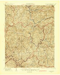
1927 Map of Gilbert
USGS Topo · Published 1945About this map
The Guyandot River winds through this coal-country landscape where the borders of Logan, Mingo, and Wyoming counties meet. This 1925 cultural revision documents a region defined by its steep geography and narrow valley settlements. The Norfolk and Western RR tracks follow the river's path, serving industrial outposts like War Eagle and Wharncliffe in the south. The map's high density of family-named landmarks and local institutions, such as the Craig Hatfield School and Rockhouse Church, provides a clear view of Appalachian social structure before modern highway consolidation. From the northern heights of Buffalo Mountain down to the southern settlement at Mohawk, the placement of numerous one-room schoolhouses like Mudhole School and Toler School reflects the era's decentralized community life.
Find a feature on this map
97 named features on this map. Tap any name to fly to it.
Don’t see what you’re looking for? This feature index may not catch every label — zoom into the map to look around manually.
Map Details
Editions of this 1927 Gilbert Map
4 editions found
Other maps of this area

1886 · Grundy
USGS Topo · 1:125,000

1887 · Warfield
USGS Topo · 1:125,000

1890 · Grundy
USGS Topo · 1:125,000

1891 · Tazewell
USGS Topo · 1:125,000

1891 · Oceana
USGS Topo · 1:125,000

1891 · Warfield
USGS Topo · 1:125,000

1892 · Grundy
USGS Topo · 1:125,000

1893 · Oceana
USGS Topo · 1:125,000

1895 · Tazewell
USGS Topo · 1:125,000

1897 · Tazewell
USGS Topo · 1:125,000