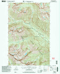
2002 Map of Gilbert
USGS Topo · Published 2006About this map
Gilbert and the upper reaches of the North Fork Twisp River are the central focus of this high-elevation mountain study. The settlement at Gilbert serves as a remote terminus for the Winthrop RD and Twisp RD, marking a transition from accessible valley roads to the protected wilderness. Mining history is evident across the slopes, with the Crescent Mine and various Mines and Prospects scattered near the headwaters of the Twisp River forks. This area is defined by its drainage systems, including South Creek, Louis Creek, and Williams Creek, which flow from the dramatic heights of the Sawtooth Ridge. High-altitude water bodies such as Louis Lake, North Lake, and Scatter Lake are tucked beneath peaks like Abernathy Peak and Reynolds Peak, illustrating the glacier-carved character of the Okanogan National Forest.
Find a feature on this map
41 named features on this map. Tap any name to fly to it.
Don’t see what you’re looking for? This feature index may not catch every label — zoom into the map to look around manually.
Map Details
Editions of this 2002 Gilbert Map
This is the sole edition of this map. No revisions or reprints were ever made.
Other maps of this area

1899 · Methow
USGS Topo · 1:125,000

1901 · Methow
USGS Topo · 1:125,000

1902 · Stehekin
USGS Topo · 1:125,000

1904 · Stehekin
USGS Topo · 1:125,000

1920 · Slate Pass
USGS Topo · 1:125,000

1955 · Concrete
USGS Topo · 1:250,000

1958 · Concrete
USGS Topo · 1:250,000

1962 · Concrete
USGS Topo · 1:250,000

1962 · Mazama
USGS Topo · 1:62,500

1963 · Washington Pass
USGS Topo · 1:24,000