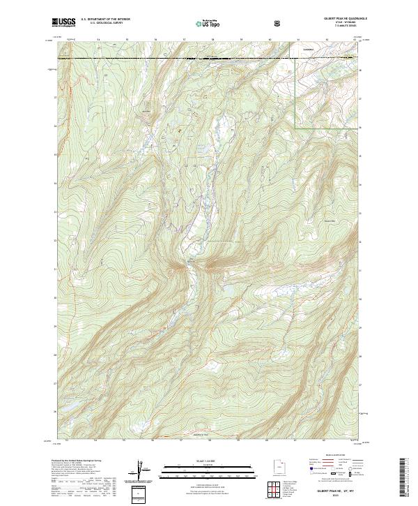
2023 Map of Gilbert Peak NE
USGS Topo · Published 2023About this map
The Wyoming and Utah state line bisects this high-elevation landscape, where the northern edge of the High Uintas Wilderness meets the Wasatch National Forest. The drainage patterns are defined by the Henrys Fork and the West Fork Beaver Creek, carving through the varied terrain between Red Mtn and Poison Mtn. This area is marked by its remote high-country character, featuring isolated water bodies like Alligator Lake and Quarter Corner Lake.
Find a feature on this map
31 named features on this map. Tap any name to fly to it.
Don’t see what you’re looking for? This feature index may not catch every label — zoom into the map to look around manually.
Map Details
Editions of this 2023 Gilbert Peak NE Map
This is the sole edition of this map. No revisions or reprints were ever made.
Other maps of this area

1885 · Uinta
USGS Topo · 1:250,000

1905 · Gilbert Peak
USGS Topo · 1:125,000

1906 · Gilbert Peak
USGS Topo · 1:125,000

1954 · Salt Lake City
USGS Topo · 1:250,000

1954 · Ogden
USGS Topo · 1:250,000

1958 · Ogden
USGS Topo · 1:250,000

1958 · Salt Lake City
USGS Topo · 1:250,000

1960 · Ogden
USGS Topo · 1:250,000

1960 · Salt Lake City
USGS Topo · 1:250,000
1964 · Lonetree
USGS Topo · 1:24,000