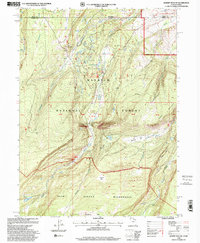
1998 Map of Gilbert Peak NE
USGS Topo · Published 2001About this map
The Bridger Lake Oil Field defines the industrial footprint within this section of the Wasatch National Forest along the border of Utah and Wyoming. Several oil wells are scattered across the terrain near Bridger Lake and Quarter Corner Lake, illustrating the intersection of resource extraction and public recreation. The landscape is dominated by the drainage of Henrys Fork, which flows northward through The Narrows, a constriction between Red Mountain and the high country to the south.
Find a feature on this map
31 named features on this map. Tap any name to fly to it.
Don’t see what you’re looking for? This feature index may not catch every label — zoom into the map to look around manually.
Map Details
Editions of this 1998 Gilbert Peak NE Map
This is the sole edition of this map. No revisions or reprints were ever made.
Other maps of this area

1885 · Uinta
USGS Topo · 1:250,000

1905 · Gilbert Peak
USGS Topo · 1:125,000

1906 · Gilbert Peak
USGS Topo · 1:125,000

1954 · Salt Lake City
USGS Topo · 1:250,000

1954 · Ogden
USGS Topo · 1:250,000

1958 · Ogden
USGS Topo · 1:250,000

1958 · Salt Lake City
USGS Topo · 1:250,000

1960 · Ogden
USGS Topo · 1:250,000

1960 · Salt Lake City
USGS Topo · 1:250,000
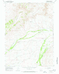
1964 · Lonetree
USGS Topo · 1:24,000