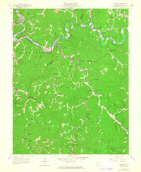
1963 Map of Gilbert
USGS Topo · Published 1964About this map
The Guyandotte River snakes through the deep valleys of Mingo and Wyoming Counties, serving as the primary corridor for the Norfolk and Western railroad and the towns of Gilbert and Justice. During the early 1960s, this region was defined by its coal-country infrastructure, where narrow hollows like Lizard Run and Honey Run provided the only level ground for settlement. The map reveals a community-centered landscape, anchored by landmarks such as the Stafford Ch, Justice Ch, and Huff Creek Sch, indicating where the social life of these river-valley enclaves was concentrated.
Find a feature on this map
82 named features on this map. Tap any name to fly to it.
Don’t see what you’re looking for? This feature index may not catch every label — zoom into the map to look around manually.
Map Details
Editions of this 1963 Gilbert Map
3 editions found
Other maps of this area

1891 · Tazewell
USGS Topo · 1:125,000

1891 · Oceana
USGS Topo · 1:125,000

1893 · Oceana
USGS Topo · 1:125,000

1895 · Tazewell
USGS Topo · 1:125,000

1897 · Tazewell
USGS Topo · 1:125,000

1898 · Oceana
USGS Topo · 1:125,000

1909 · Gilbert
USGS Topo · 1:48,000

1910 · Pineville
USGS Topo · 1:48,000

1910 · Iaeger
USGS Topo · 1:48,000

1912 · Gilbert
USGS Topo · 1:62,500