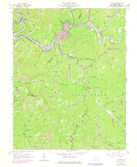
1963 Map of Gilbert
USGS Topo · Published 1978About this map
The Guyandotte River winds through the heart of the Stafford District, where the Norfolk and Western Railway follows the riverbanks past industrial coal operations and tight mountain settlements. This 1963 survey, updated with late-1970s photogrammetric data, captures the region's transition as the proposed R. P. Bailey Dam prepared to submerge sections of the valley. Local life centers on coal-country communities like Gilbert, Justice, and Hanover, while the landscape is dotted with small family burial grounds such as the Lester Cems. Evidence of the area's extraction economy is visible in the numerous Strip Mines and the old railroad grade near the river. Remote educational and spiritual sites, including the Longpole Sch and Little Huff Creek Ch, emphasize the dispersed nature of these Appalachian hollows before modern infrastructure altered the terrain.
Find a feature on this map
77 named features on this map. Tap any name to fly to it.
Don’t see what you’re looking for? This feature index may not catch every label — zoom into the map to look around manually.
Map Details
Editions of this 1963 Gilbert Map
3 editions found
Other maps of this area

1891 · Tazewell
USGS Topo · 1:125,000

1891 · Oceana
USGS Topo · 1:125,000

1893 · Oceana
USGS Topo · 1:125,000

1895 · Tazewell
USGS Topo · 1:125,000

1897 · Tazewell
USGS Topo · 1:125,000

1898 · Oceana
USGS Topo · 1:125,000

1909 · Gilbert
USGS Topo · 1:48,000

1910 · Pineville
USGS Topo · 1:48,000

1910 · Iaeger
USGS Topo · 1:48,000

1912 · Gilbert
USGS Topo · 1:62,500