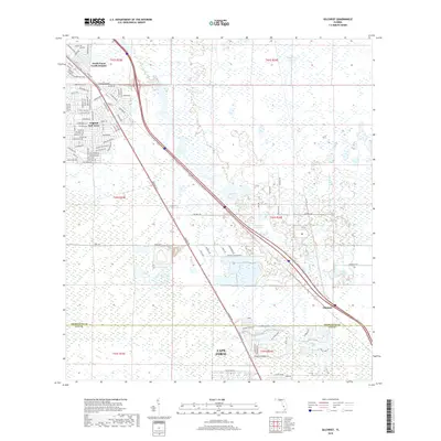
2018 Map of Gilchrist
USGS Topo · Published 2018About this map
South Punta Gorda Heights and Tropical Gulf Acres mark the northwestern corner of this Florida landscape, where residential street grids begin to reach into the low-lying terrain near the Charlotte Co Lee Co boundary. The area is defined by its transition from suburban development to open, water-dotted lands, with the prominent Tamiami Trl and Interstate 75 cutting a diagonal path southeast toward Gilchrist. This 2018 survey reveals a network of planned but sparsely settled corridors, including Orange Blossom Blvd and Valparaiso Blvd, which navigate a mosaic of wetlands and small water bodies like Spring Lake and Powerline Lake. The southern edge of the sheet transitions into the northern reaches of Cape Coral, showing the continued expansion of drainage and infrastructure through the pine and palmetto flats characteristic of the region.
Find a feature on this map
98 named features on this map. Tap any name to fly to it.
Don’t see what you’re looking for? This feature index may not catch every label — zoom into the map to look around manually.
Map Details
Editions of this 2018 Gilchrist Map
This is the sole edition of this map. No revisions or reprints were ever made.
Other maps of this area

1956 · Cleveland
USGS Topo · 1:24,000

1956 · Punta Gorda SE
USGS Topo · 1:24,000

1956 · Bermont
USGS Topo · 1:24,000

1956 · West Palm Beach
USGS Topo · 1:250,000

1956 · Tampa
USGS Topo · 1:250,000

1956 · Charlotte Harbor
USGS Topo · 1:250,000

1957 · West Palm Beach
USGS Topo · 1:250,000

1957 · Tuckers Corner
USGS Topo · 1:24,000

1957 · Punta Gorda
USGS Topo · 1:24,000

1957 · Gilchrist
USGS Topo · 1:24,000