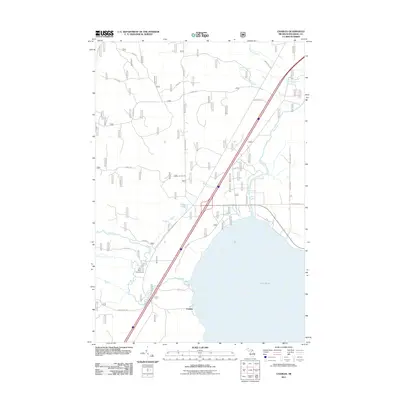
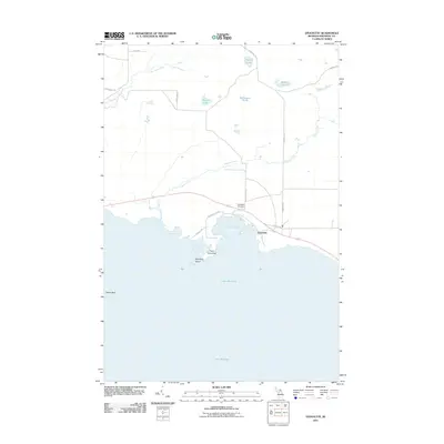
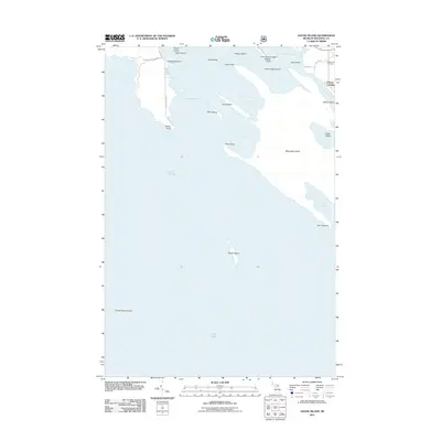
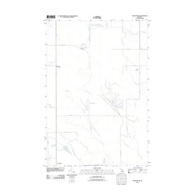
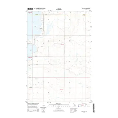
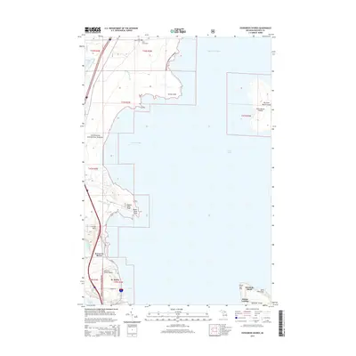
1931 Map of Gilchrist NE
USGS Topo · Published 1931About this map
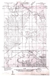
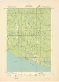
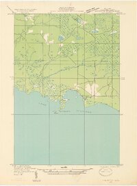
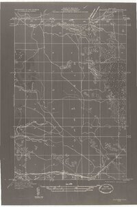
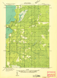
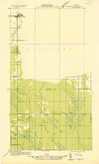
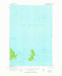
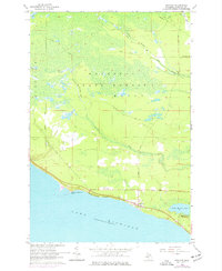
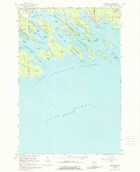
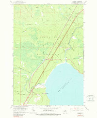
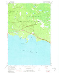
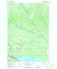
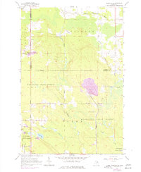
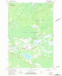
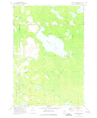
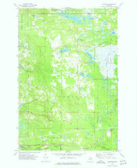
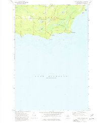
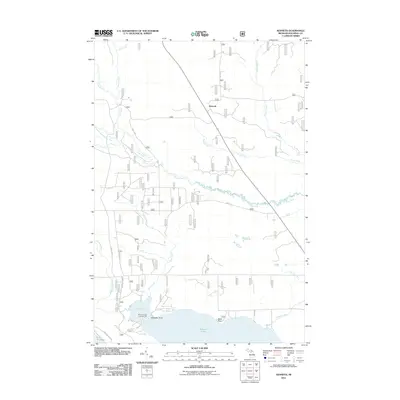
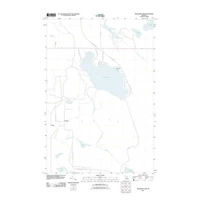
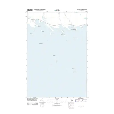
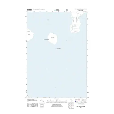
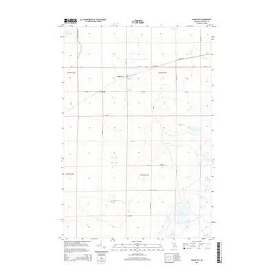
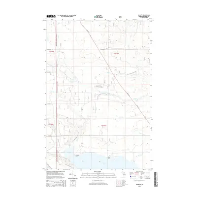
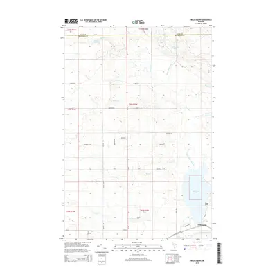
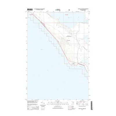
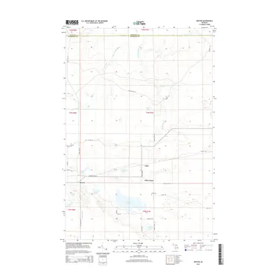
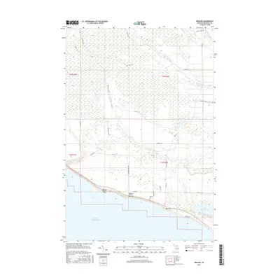
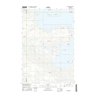
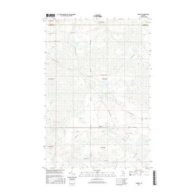
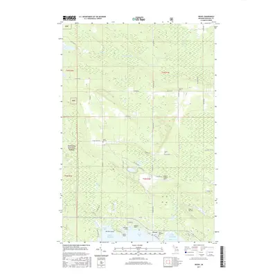
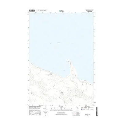
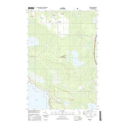
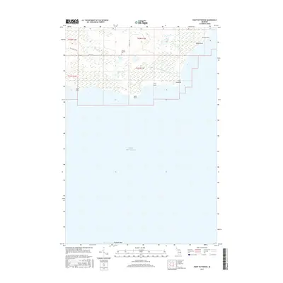
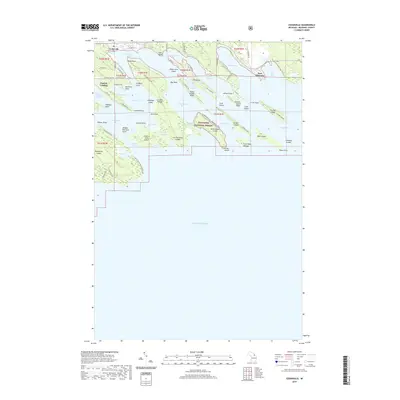
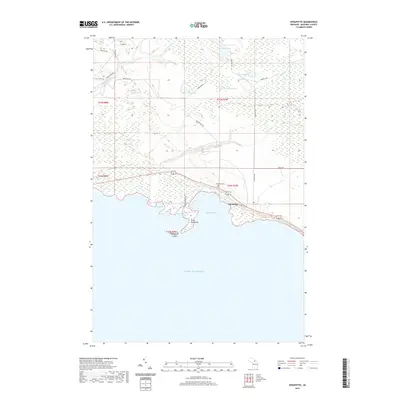
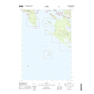
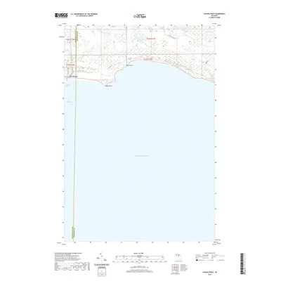
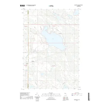
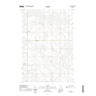
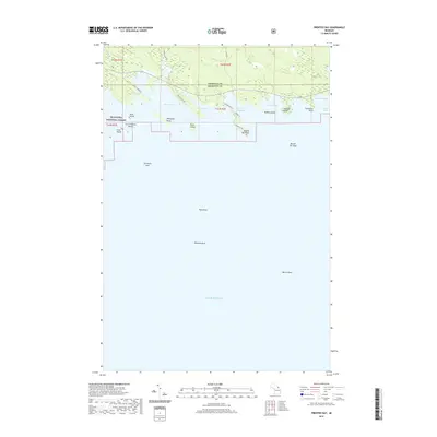
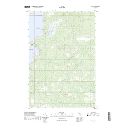
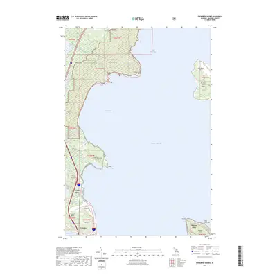
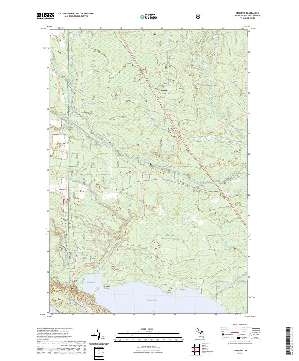
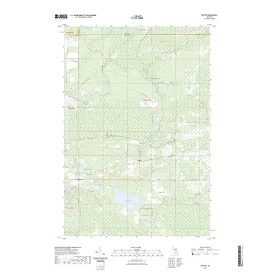
Garnet and the surrounding timber and marshlands of Hudson township define this Upper Peninsula landscape during the early 1930s. The region is shaped by the Minneapolis St Paul and Sault Ste Marie railroad, which provides the primary transportation artery through the southern portion of the sheet. Industrial activity is centered around the Hendricks Quarry and a nearby Gravel Pit, indicating the importance of resource extraction to the local economy. The terrain is characterized by extensive wetlands such as Kings Marsh and a network of waterways including the Black River and Sage River. A Fire Tower stands as a sentinel over these woodlands, while local genealogy is rooted at Maplewood Cem. This survey represents an early application of aerial photography, compiled with assistance from the Army Air Corps to map the intricate boundaries between land and water near Garnet Lake.
Find a feature on this map
15 named features on this map. Tap any name to fly to it.
Don’t see what you’re looking for? This feature index may not catch every label — zoom into the map to look around manually.
Map Details
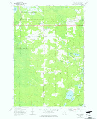
Editions of this 1931 Gilchrist NE Map
2 editions found
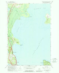
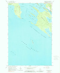
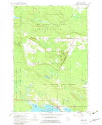
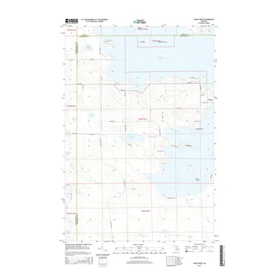
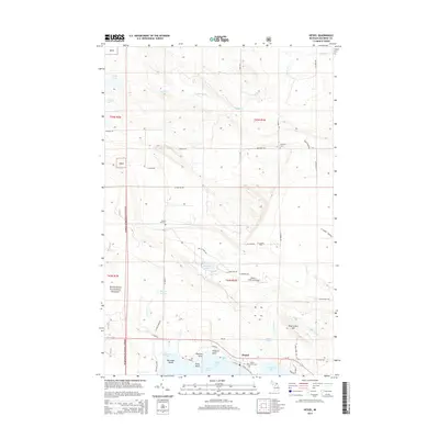
Historical Maps of Garfield Township Through Time
204 maps found
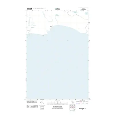
1931 Blaney NE
Mackinac County, MI
1931 Blaney SE
Mackinac County, MI

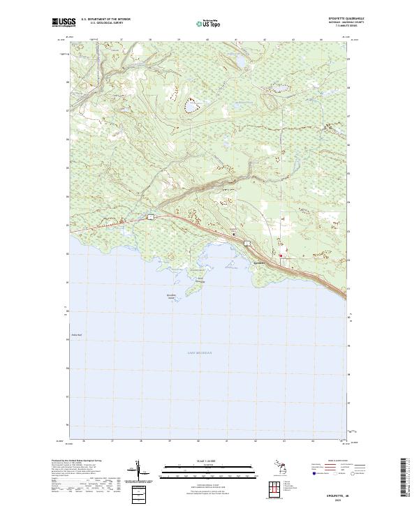
1931 Epoufette NW
Mackinac County, MI
1931 Epoufette SE
Mackinac County, MI
1931 Epoufette SW
Mackinac County, MI
1931 Gilchrist NE
Mackinac County, MI
1931 Gilchrist NW
Mackinac County, MI
1931 Gould City NE
Mackinac County, MI
1931 Gould City NW
Mackinac County, MI
1931 Gould City SE
Mackinac County, MI
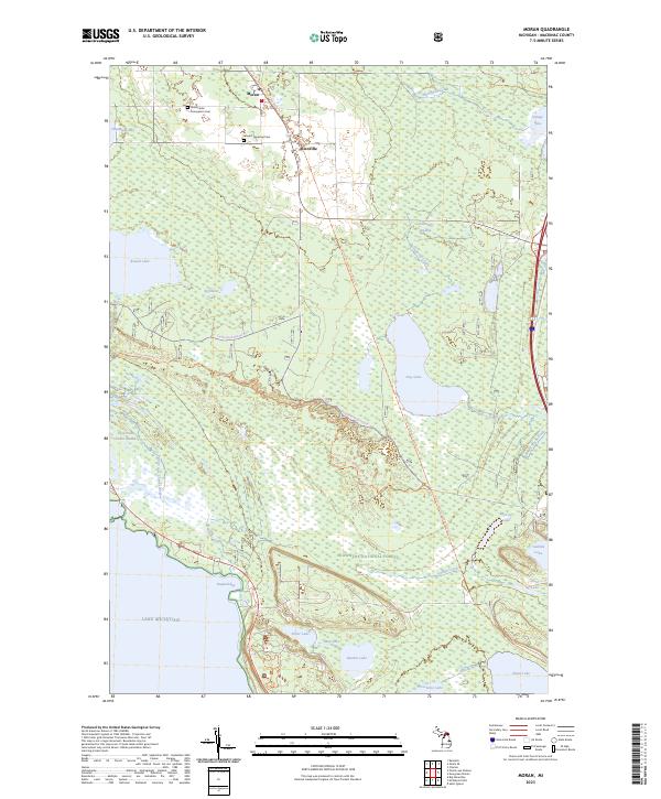
1931 Moran NE
Mackinac County, MI
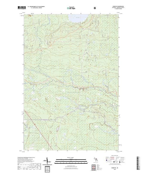
1931 Ozark SE
Mackinac County, MI
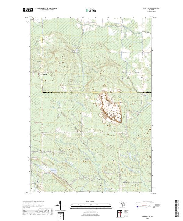
1931 Pickford SE
Mackinac County, MI
1931 Seul Choix Point NE
Mackinac County, MI

1931 St Ignace NW
Mackinac County, MI
1932 St Ignace NE
Mackinac County, MI

1948 Moran NE
Mackinac County, MI
1948 Moran NW
Mackinac County, MI
1955 Hog Island
Mackinac County, MI
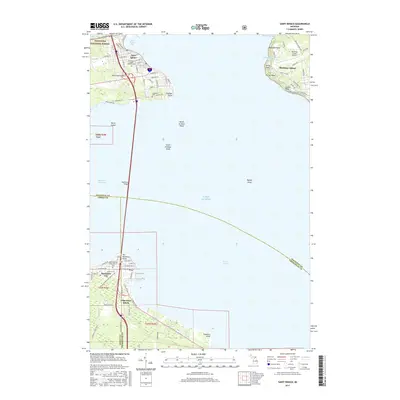
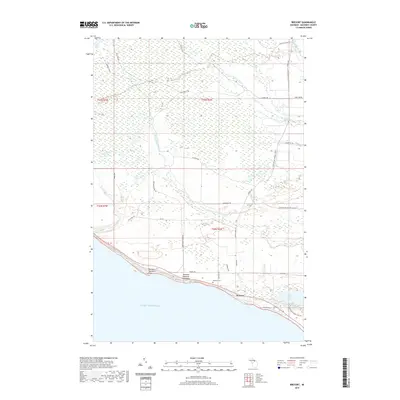
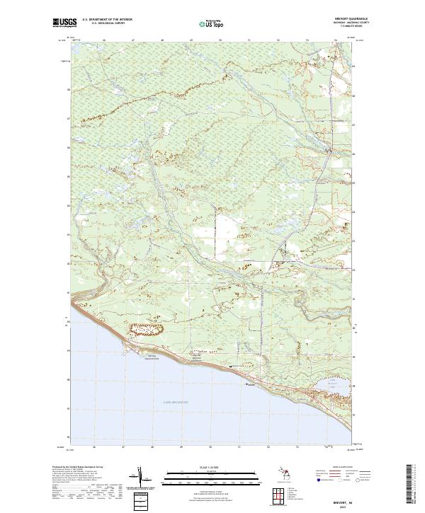
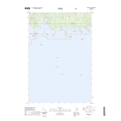
1964 Brevort
Mackinac County, MI
1964 Cedarville
Mackinac County, MI
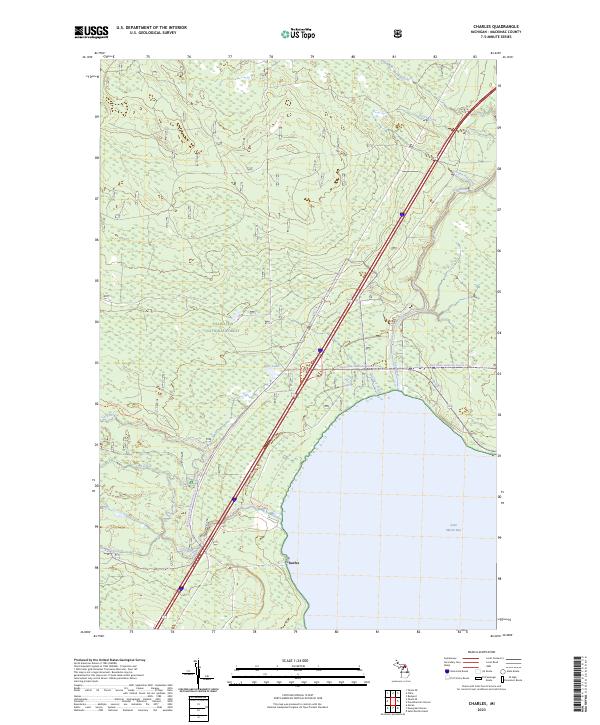
1964 Charles
Mackinac County, MI
1964 Epoufette
Mackinac County, MI
1964 Evergreen Shores
Mackinac County, MI
1964 Goose Island
Mackinac County, MI
1964 Hessel
Mackinac County, MI
1964 Kenneth
Mackinac County, MI
1964 McRae Bay
Mackinac County, MI
1964 Moran
Mackinac County, MI
1964 Ozark SE
Mackinac County, MI
1964 Pickford SE
Mackinac County, MI
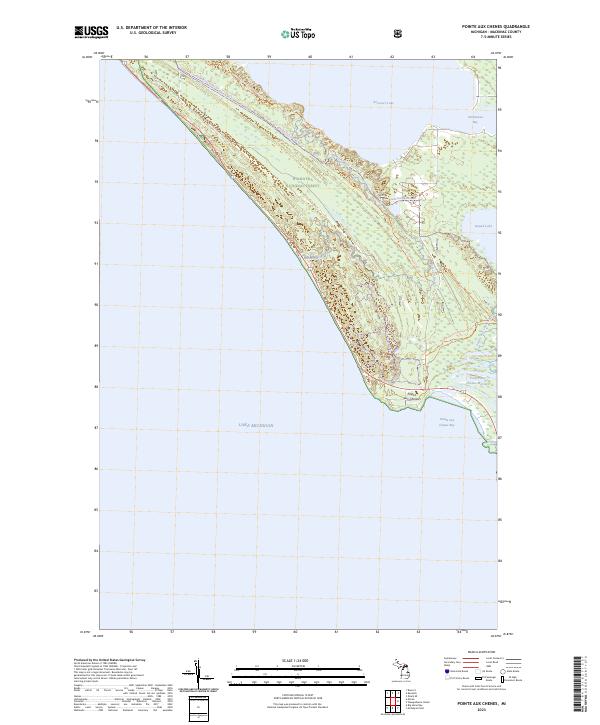
1964 Pointe Aux Chenes
Mackinac County, MI
1964 Pontchartrain Shores
Mackinac County, MI
1964 Prentiss Bay
Mackinac County, MI
1964 Rexton
Mackinac County, MI
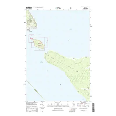
1964 Round Island
Mackinac County, MI
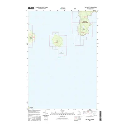
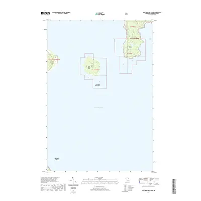
1964 St. Martin Island
Mackinac County, MI
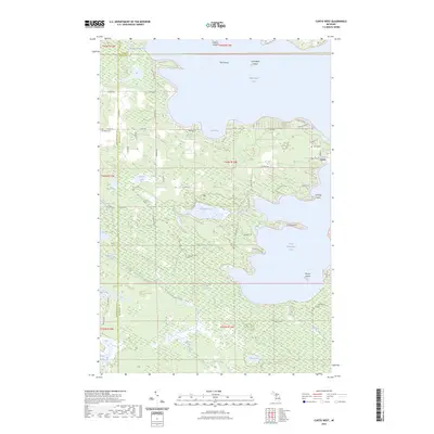
1972 Curtis West
Mackinac County, MI

1972 Hughes Point
Mackinac County, MI
1972 Milakokia Lake
Mackinac County, MI
1973 Curtis East
Mackinac County, MI
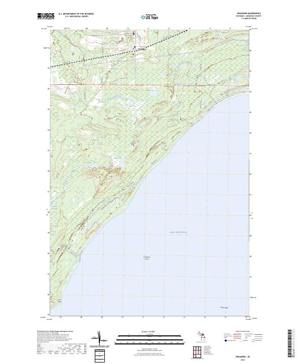
1973 Engadine
Mackinac County, MI
1973 Garnet
Mackinac County, MI
1973 Gilchrist
Mackinac County, MI
1973 Gould City
Mackinac County, MI
1973 Hog Island Point
Mackinac County, MI
1973 Millecoquins
Mackinac County, MI
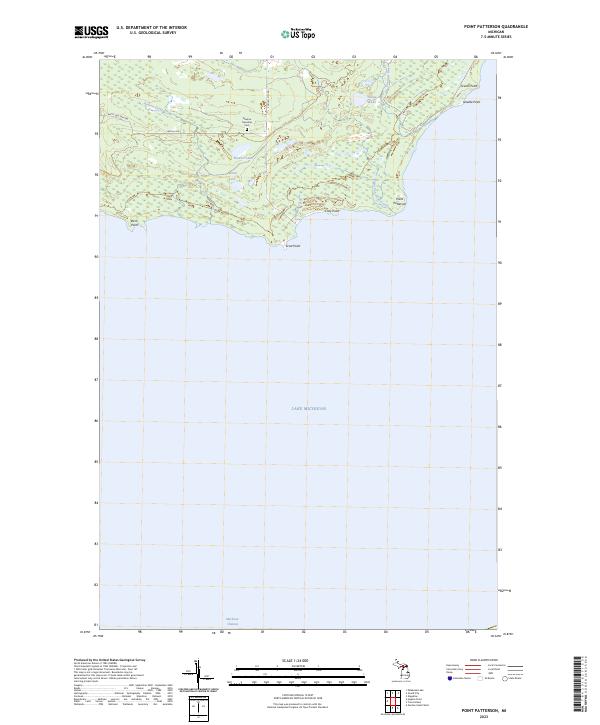
1973 Point Patterson
Mackinac County, MI
1985 Manistique Lake
Mackinac County, MI
2011 Brevort
Mackinac County, MI
2011 Cedarville
Mackinac County, MI
2011 Charles
Mackinac County, MI
2011 Curtis East
Mackinac County, MI
2011 Curtis West
Mackinac County, MI
2011 Engadine
Mackinac County, MI
2011 Epoufette
Mackinac County, MI
2011 Evergreen Shores
Mackinac County, MI
2011 Garnet
Mackinac County, MI
2011 Gilchrist
Mackinac County, MI
2011 Goose Island
Mackinac County, MI
2011 Gould City
Mackinac County, MI
2011 Hessel
Mackinac County, MI
2011 Hog Island Point
Mackinac County, MI
2011 Hughes Point
Mackinac County, MI
2011 Kenneth
Mackinac County, MI
2011 McRae Bay
Mackinac County, MI
2011 McRae Bay OE E
Mackinac County, MI
2011 Milakokia Lake
Mackinac County, MI
2011 Millecoquins
Mackinac County, MI
2011 Moran
Mackinac County, MI
2011 Ozark SE
Mackinac County, MI
2011 Pickford SE
Mackinac County, MI
2011 Pointe aux Chenes
Mackinac County, MI
2011 Point Patterson
Mackinac County, MI
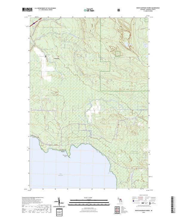
2011 Pontchartrain Shores
Mackinac County, MI
2011 Prentiss Bay
Mackinac County, MI
2011 Rexton
Mackinac County, MI
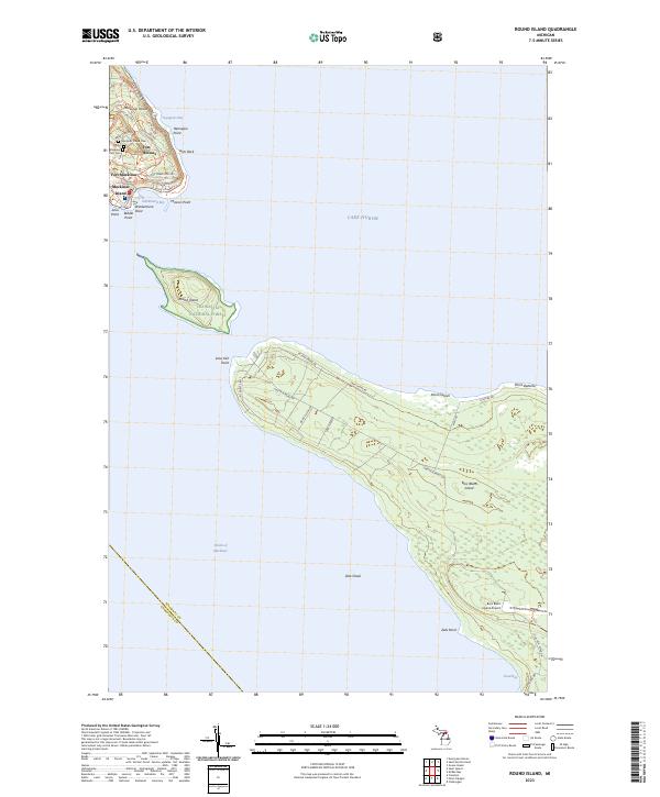
2011 Round Island
Mackinac County, MI
2011 Saint Ignace
Mackinac County, MI
2011 Saint Martin Island
Mackinac County, MI
2014 Brevort
Mackinac County, MI
2014 Cedarville
Mackinac County, MI
2014 Charles
Mackinac County, MI
2014 Curtis East
Mackinac County, MI
2014 Curtis West
Mackinac County, MI
2014 Engadine
Mackinac County, MI
2014 Epoufette
Mackinac County, MI
2014 Evergreen Shores
Mackinac County, MI
2014 Garnet
Mackinac County, MI
2014 Gilchrist
Mackinac County, MI
2014 Goose Island
Mackinac County, MI
2014 Gould City
Mackinac County, MI
2014 Hessel
Mackinac County, MI
2014 Hog Island Point
Mackinac County, MI
2014 Hughes Point
Mackinac County, MI
2014 Kenneth
Mackinac County, MI
2014 McRae Bay
Mackinac County, MI
2014 McRae Bay OE E
Mackinac County, MI
2014 Milakokia Lake
Mackinac County, MI
2014 Millecoquins
Mackinac County, MI
2014 Moran
Mackinac County, MI
2014 Ozark SE
Mackinac County, MI
2014 Pickford SE
Mackinac County, MI
2014 Pointe aux Chenes
Mackinac County, MI
2014 Point Patterson
Mackinac County, MI
2014 Pontchartrain Shores
Mackinac County, MI
2014 Prentiss Bay
Mackinac County, MI
2014 Rexton
Mackinac County, MI
2014 Round Island
Mackinac County, MI
2014 Saint Ignace
Mackinac County, MI
2014 Saint Martin Island
Mackinac County, MI
2017 Brevort
Mackinac County, MI
2017 Cedarville
Mackinac County, MI
2017 Charles
Mackinac County, MI
2017 Curtis East
Mackinac County, MI
2017 Curtis West
Mackinac County, MI
2017 Engadine
Mackinac County, MI
2017 Epoufette
Mackinac County, MI
2017 Evergreen Shores
Mackinac County, MI
2017 Garnet
Mackinac County, MI
2017 Gilchrist
Mackinac County, MI
2017 Goose Island
Mackinac County, MI
2017 Gould City
Mackinac County, MI
2017 Hessel
Mackinac County, MI
2017 Hog Island Point
Mackinac County, MI
2017 Hughes Point
Mackinac County, MI
2017 Kenneth
Mackinac County, MI
2017 McRae Bay
Mackinac County, MI
2017 McRae Bay OE E
Mackinac County, MI
2017 Milakokia Lake
Mackinac County, MI
2017 Millecoquins
Mackinac County, MI
2017 Moran
Mackinac County, MI
2017 Ozark SE
Mackinac County, MI
2017 Pickford SE
Mackinac County, MI
2017 Pointe aux Chenes
Mackinac County, MI
2017 Point Patterson
Mackinac County, MI
2017 Pontchartrain Shores
Mackinac County, MI
2017 Prentiss Bay
Mackinac County, MI
2017 Rexton
Mackinac County, MI
2017 Round Island
Mackinac County, MI
2017 Saint Ignace
Mackinac County, MI
2017 Saint Martin Island
Mackinac County, MI
2019 Brevort
Mackinac County, MI
2019 Cedarville
Mackinac County, MI
2019 Charles
Mackinac County, MI
2019 Curtis East
Mackinac County, MI

2019 Curtis West
Mackinac County, MI
2019 Engadine
Mackinac County, MI
2019 Epoufette
Mackinac County, MI
2019 Evergreen Shores
Mackinac County, MI
2019 Garnet
Mackinac County, MI
2019 Gilchrist
Mackinac County, MI
2019 Goose Island
Mackinac County, MI
2019 Gould City
Mackinac County, MI
2019 Hessel
Mackinac County, MI
2019 Hog Island Point
Mackinac County, MI
2019 Hughes Point
Mackinac County, MI
2019 Kenneth
Mackinac County, MI
2019 McRae Bay
Mackinac County, MI
2019 McRae Bay OE E
Mackinac County, MI
2019 Milakokia Lake
Mackinac County, MI
2019 Millecoquins
Mackinac County, MI
2019 Moran
Mackinac County, MI
2019 Ozark SE
Mackinac County, MI
2019 Pickford SE
Mackinac County, MI
2019 Pointe aux Chenes
Mackinac County, MI
2019 Point Patterson
Mackinac County, MI
2019 Pontchartrain Shores
Mackinac County, MI
2019 Prentiss Bay
Mackinac County, MI
2019 Rexton
Mackinac County, MI
2019 Round Island
Mackinac County, MI
2019 Saint Ignace
Mackinac County, MI
2019 Saint Martin Island
Mackinac County, MI
2023 Brevort
Mackinac County, MI
2023 Cedarville
Mackinac County, MI
2023 Charles
Mackinac County, MI
2023 Curtis East
Mackinac County, MI
2023 Curtis West
Mackinac County, MI
2023 Engadine
Mackinac County, MI
2023 Epoufette
Mackinac County, MI
2023 Evergreen Shores
Mackinac County, MI
2023 Garnet
Mackinac County, MI
2023 Gilchrist
Mackinac County, MI
2023 Goose Island
Mackinac County, MI
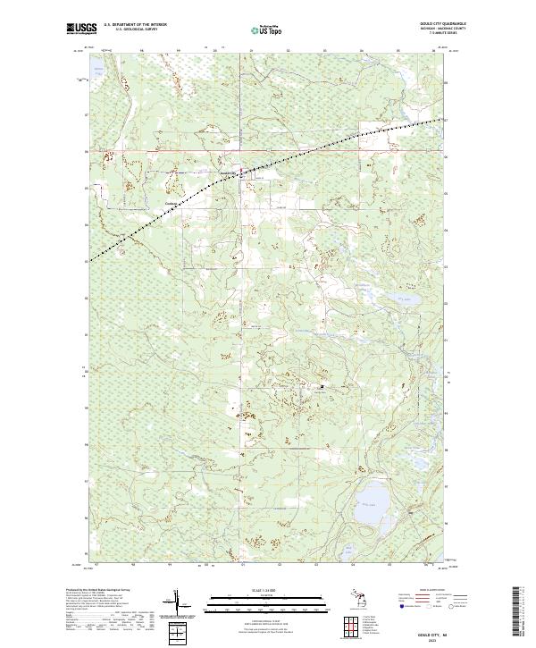
2023 Gould City
Mackinac County, MI
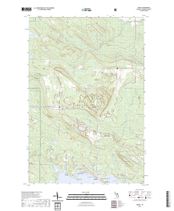
2023 Hessel
Mackinac County, MI
2023 Hog Island Point
Mackinac County, MI
2023 Hughes Point
Mackinac County, MI
2023 Kenneth
Mackinac County, MI
2023 McRae Bay
Mackinac County, MI
2023 McRae Bay OE E
Mackinac County, MI
2023 Milakokia Lake
Mackinac County, MI
2023 Millecoquins
Mackinac County, MI
2023 Moran
Mackinac County, MI
2023 Ozark SE
Mackinac County, MI
2023 Pickford SE
Mackinac County, MI
2023 Pointe aux Chenes
Mackinac County, MI
2023 Point Patterson
Mackinac County, MI
2023 Pontchartrain Shores
Mackinac County, MI
2023 Prentiss Bay
Mackinac County, MI
2023 Rexton
Mackinac County, MI
2023 Round Island
Mackinac County, MI
2023 Saint Ignace
Mackinac County, MI
2023 Saint Martin Island
Mackinac County, MI
Featured Locations
- Mackinac County, MI
- Garfield Township, MI
- Hudson Township, MI
- Pentland Township, MI
- Garnet, Hudson Township