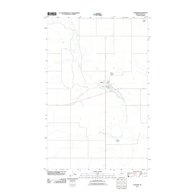
2011 Map of Gildford
USGS Topo · Published 2011About this map
The settlement of Gildford sits in the High Line region of Montana, serving as a hub for the surrounding agricultural plains. Public life and community infrastructure are centered along the intersection of County Hwy 449 and 1st Ave, where the Gildford Post Office and Gildford Rural Fire Dept maintain local services. The landscape is defined by the winding course of Sage Creek, which carves through the prairie and creates distinct geographical markers such as Alkali Coulee to the north and England Coulee to the south.
Find a feature on this map
11 named features on this map. Tap any name to fly to it.
Don’t see what you’re looking for? This feature index may not catch every label — zoom into the map to look around manually.
Map Details
Editions of this 2011 Gildford Map
This is the sole edition of this map. No revisions or reprints were ever made.
Other maps of this area

1904 · Boxelder
USGS Topo · 1:62,500

1906 · Kremlin
USGS Topo · 1:62,500

1906 · Boxelder
USGS Topo · 1:62,500

1919 · Big Sandy
USGS Topo · 1:125,000

1920 · Gildford
USGS Topo · 1:125,000

1943 · Gildford
USGS Topo · 1:125,000

1954 · Shelby
USGS Topo · 1:250,000

1958 · Shelby
USGS Topo · 1:250,000
1969 · Sage Lake
USGS Topo · 1:24,000

1969 · Box Elder NW
USGS Topo · 1:24,000