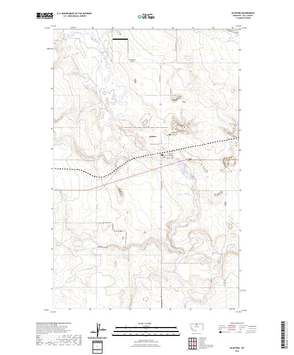
2024 Map of Gildford
USGS Topo · Published 2024About this map
Gildford serves as the central hub of this Hill County landscape, where the town grid is positioned just north of the local transport corridor. The terrain is defined by the winding course of Sage Creek, which cuts through the prairie alongside significant landforms like Gildford Hill. To the northeast of the town site, the Gildford Hill County Cem provides a specific point of interest for genealogists tracing local families in this part of Montana. The map illustrates a rural economy dependent on a network of section roads such as Gilford Rd and Gilford Rd S, connecting isolated landmarks like Sandy Rock Airport to the broader region. Water drainage patterns are marked by several distinct depressions, including England Coulee and Alkali Coulee, which shape the agricultural potential of the surrounding plains.
Find a feature on this map
19 named features on this map. Tap any name to fly to it.
Don’t see what you’re looking for? This feature index may not catch every label — zoom into the map to look around manually.
Map Details
Editions of this 2024 Gildford Map
This is the sole edition of this map. No revisions or reprints were ever made.
Other maps of this area

1904 · Boxelder
USGS Topo · 1:62,500

1906 · Kremlin
USGS Topo · 1:62,500

1906 · Boxelder
USGS Topo · 1:62,500

1919 · Big Sandy
USGS Topo · 1:125,000

1920 · Gildford
USGS Topo · 1:125,000

1943 · Gildford
USGS Topo · 1:125,000

1954 · Shelby
USGS Topo · 1:250,000

1958 · Shelby
USGS Topo · 1:250,000
1969 · Sage Lake
USGS Topo · 1:24,000

1969 · Box Elder NW
USGS Topo · 1:24,000