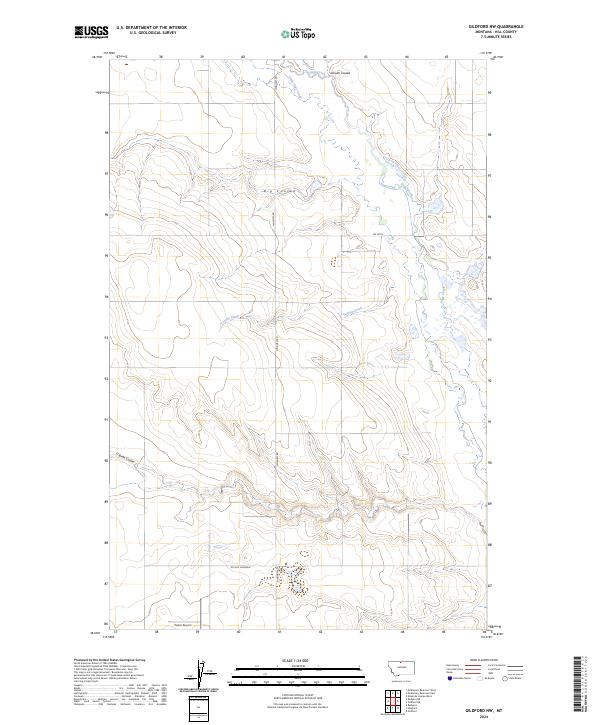
2024 Map of Gildford NW
USGS Topo · Published 2024About this map
Sage Creek and its tributaries define the drainage patterns of this Hill County landscape, where the high plains are deeply incised by erosion. The map documents the intricate network of seasonal watercourses like Tootsie Creek and Little Sage Creek as they move through pronounced landforms such as Big Coulee and Schultz Coulee. These features illustrate the geological transition between upland plateaus and the lower basin drainages.
Find a feature on this map
16 named features on this map. Tap any name to fly to it.
Don’t see what you’re looking for? This feature index may not catch every label — zoom into the map to look around manually.
Map Details
Editions of this 2024 Gildford NW Map
This is the sole edition of this map. No revisions or reprints were ever made.
Other maps of this area

1919 · Alma
USGS Topo · 1:125,000

1920 · Gildford
USGS Topo · 1:125,000

1943 · Gildford
USGS Topo · 1:125,000

1954 · Shelby
USGS Topo · 1:250,000

1958 · Shelby
USGS Topo · 1:250,000

1969 · Gildford NE
USGS Topo · 1:24,000

1969 · Gildford NW
USGS Topo · 1:24,000

1969 · Hingham
USGS Topo · 1:24,000
1969 · Gildford
USGS Topo · 1:24,000
1972 · Rudyard
USGS Topo · 1:24,000