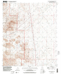
1996 Map of Gillespie Mountain
USGS Topo · Published 2002About this map
Gillespie Mountain anchors the high ground in this arid Graham County landscape, where the Coronado National Forest boundary meets ranching land. The map reveals a network of canyons and drainages, most notably Dutch Henry Canyon and Rightland Can, cutting through the western slopes. Evidence of land use is centered on the P Ranch and the locality of Van Gausig, while numerous Water Tanks are scattered throughout the draws to support livestock in this dry environment. The presence of Stockton Pass suggests a vital natural route through the foothills, connecting the seasonal drainages of Oak Draw and Tanque Draw to the lower basins. This 1996 imagery update provides a clear view of the sparse settlement patterns and water-management infrastructure characteristic of Arizona's high desert ranges.
Find a feature on this map
20 named features on this map. Tap any name to fly to it.
Don’t see what you’re looking for? This feature index may not catch every label — zoom into the map to look around manually.
Map Details
Editions of this 1996 Gillespie Mountain Map
This is the sole edition of this map. No revisions or reprints were ever made.
Other maps of this area

1922 · Willcox
USGS Topo · 1:125,000

1942 · Mt. Graham
USGS Topo · 1:62,500

1943 · Willcox
USGS Topo · 1:62,500

1944 · Fisher Hills
USGS Topo · 1:62,500

1945 · Mt. Graham
USGS Topo · 1:62,500

1954 · Silver City
USGS Topo · 1:250,000

1957 · Luzena
USGS Topo · 1:62,500

1958 · Silver City
USGS Topo · 1:250,000

1958 · Willcox
USGS Topo · 1:62,500

1962 · Silver City
USGS Topo · 1:250,000