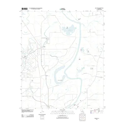
2012 Map of Gilliam
USGS Topo · Published 2012About this map
The Red River defines the landscape of this Caddo Parish corridor, where a complex network of backwaters and lowlands like Holm Lake Bottom and Dutch John Bottom sit west of the primary channel. The settlement of Gilliam serves as a local hub, supported by the Gilliam Airport and the nearby Cottage Grove Oil and Gas Field, which speaks to the region's industrial ties. Small communities and rural homesteads are scattered along the western bluffs, including Cavett. For genealogists, the map is a detailed record of local burial sites, documenting Union Chapel Cem, Egypt Hill Cem, New Egypt Hill Cem, and Prairie Cem. The varied topography is further marked by prominent overlooks such as Irvings Bluff, Coushatta Bluffs, and Carolina Bluff, which rise above the intricate system of sloughs and bayous.
Find a feature on this map
65 named features on this map. Tap any name to fly to it.
Don’t see what you’re looking for? This feature index may not catch every label — zoom into the map to look around manually.
Map Details
Editions of this 2012 Gilliam Map
This is the sole edition of this map. No revisions or reprints were ever made.
Other maps of this area

1932 · Hosston NW
USGS Topo · 1:31,680

1932 · Hosston NE
USGS Topo · 1:31,680

1932 · Hosston SW
USGS Topo · 1:31,680

1932 · Hosston SE
USGS Topo · 1:31,680

1932 · Bossier NW
USGS Topo · 1:31,680

1932 · Shreveport NE
USGS Topo · 1:31,680

1948 · Mooringsport
USGS Topo · 1:62,500

1948 · Vivian
USGS Topo · 1:62,500

1948 · Bossier City
USGS Topo · 1:62,500

1950 · Plain Dealing SW
USGS Topo · 1:31,680