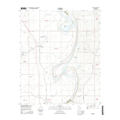
2015 Map of Gilliam
USGS Topo · Published 2015About this map
Gilliam and Belcher anchor the landscape of northern Caddo Parish in this detailed 2015 study, situated between the winding Red River and the complex wetlands to the west. The area's settlement pattern is defined by the fertile lowlands of the Dutch John Bottom and Holm Lake Bottom, where a network of levees and drainage bayous like Horseshoe Bayou and Dooley Bayou manage the river's influence. Elevated landmarks such as Coushatta Bluffs and Carolina Bluff provide a stark contrast to the floodplains below.
Find a feature on this map
74 named features on this map. Tap any name to fly to it.
Don’t see what you’re looking for? This feature index may not catch every label — zoom into the map to look around manually.
Map Details
Editions of this 2015 Gilliam Map
This is the sole edition of this map. No revisions or reprints were ever made.
Other maps of this area

1932 · Hosston NW
USGS Topo · 1:31,680

1932 · Hosston NE
USGS Topo · 1:31,680

1932 · Hosston SW
USGS Topo · 1:31,680

1932 · Hosston SE
USGS Topo · 1:31,680

1932 · Bossier NW
USGS Topo · 1:31,680

1932 · Shreveport NE
USGS Topo · 1:31,680

1948 · Mooringsport
USGS Topo · 1:62,500

1948 · Vivian
USGS Topo · 1:62,500

1948 · Bossier City
USGS Topo · 1:62,500

1950 · Plain Dealing SW
USGS Topo · 1:31,680