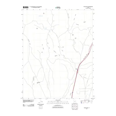
2011 Map of Gillies Hill
USGS Topo · Published 2011About this map
Fortune Mine and Harris Mine anchor the industrial history of this Beaver County landscape, where mineral extraction once defined the local economy within the high desert terrain. The area is characterized by a network of drainage features and basins, including Fortuna Canyon and Little Basin, which cut through the prominent Bald Ridges and Maple Flats. In this early 21st-century record, the landscape is dotted with essential water sources like Cowboy Spring and Wiregrass Spring, critical markers for both historical livestock grazing and early mining operations. The central geographic features, Gillies Hill and Cunningham Hill, stand above the dry washes and hollows, while the southern reaches transition into the Wildcat Fields. This survey reflects the enduring infrastructure of rural Utah, showing how local roads like Manderfield Rd and Poleline Rd navigate the complex topography of the Hogback and Fourmile Ridge.
Find a feature on this map
32 named features on this map. Tap any name to fly to it.
Don’t see what you’re looking for? This feature index may not catch every label — zoom into the map to look around manually.
Map Details
Editions of this 2011 Gillies Hill Map
This is the sole edition of this map. No revisions or reprints were ever made.
Other maps of this area

1885 · Beaver
USGS Topo · 1:250,000

1953 · Richfield
USGS Topo · 1:250,000

1954 · Beaver SE
USGS Topo · 1:24,000

1954 · Beaver NE
USGS Topo · 1:24,000

1958 · Richfield
USGS Topo · 1:250,000

1958 · Beaver
USGS Topo · 1:62,500

1958 · Adamsville
USGS Topo · 1:62,500

1962 · Cove Fort
USGS Topo · 1:62,500

1973 · Pinnacle Pass
USGS Topo · 1:24,000
1980 · Beaver
USGS Topo · 1:100,000