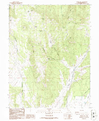
1986 Map of Gillies Hill
USGS Topo · Published 1986About this map
Gillies Hill and its surrounding high desert landscape are documented here as they appeared in the mid-1980s, based on earlier surveys and field checks. The terrain is defined by dramatic volcanic features like Crater Knoll and Red Knoll, alongside dry washes such as Cunningham Wash. The presence of several named water sources, including Hawks Nest Spring, Wiregrass Spring, and Fourmile Spring, indicates the critical importance of localized water in this arid environment.
Find a feature on this map
28 named features on this map. Tap any name to fly to it.
Don’t see what you’re looking for? This feature index may not catch every label — zoom into the map to look around manually.
Map Details
Editions of this 1986 Gillies Hill Map
This is the sole edition of this map. No revisions or reprints were ever made.
Other maps of this area

1885 · Beaver
USGS Topo · 1:250,000

1953 · Richfield
USGS Topo · 1:250,000

1954 · Beaver SE
USGS Topo · 1:24,000

1954 · Beaver NE
USGS Topo · 1:24,000

1958 · Richfield
USGS Topo · 1:250,000

1958 · Beaver
USGS Topo · 1:62,500

1958 · Adamsville
USGS Topo · 1:62,500

1962 · Cove Fort
USGS Topo · 1:62,500

1973 · Pinnacle Pass
USGS Topo · 1:24,000
1980 · Beaver
USGS Topo · 1:100,000