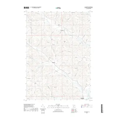
2018 Map of Gillingham
USGS Topo · Published 2018About this map
Gillingham sits at the heart of this Richland County landscape, where the ridges and hollows of the Driftless Area dictate the settlement patterns. The map detail follows the winding paths of Fancy Cr and the W Br Pine River, which carve deep valleys such as Tar Hollow and Norman Valley. These drainages served as the primary corridors for early development, evidenced by the string of rural burial grounds like Bloom City Cem and Spring Hill Cem that mark old family stakes and community centers. To the south, the terrain levels slightly near the northern reaches of Richland Center, while the uplands of English Ridge and Cribben Hill maintain their agricultural character. This 2018 survey captures the persistent rural footprint of the region, where infrastructure like the 36 Reservoir and a network of county highways connect isolated farmsteads across the dissected topography.
Find a feature on this map
75 named features on this map. Tap any name to fly to it.
Don’t see what you’re looking for? This feature index may not catch every label — zoom into the map to look around manually.
Map Details
Editions of this 2018 Gillingham Map
This is the sole edition of this map. No revisions or reprints were ever made.
Other maps of this area

1905 · Richland Center
USGS Topo · 1:125,000

1926 · La Farge
USGS Topo · 1:62,500

1927 · Hillsboro
USGS Topo · 1:62,500

1933 · Boaz
USGS Topo · 1:62,500

1958 · La Crosse
USGS Topo · 1:250,000

1960 · Richland Center
USGS Topo · 1:62,500

1961 · La Crosse
USGS Topo · 1:250,000

1965 · La Crosse
USGS Topo · 1:250,000

1965 · La Farge
USGS Topo · 1:62,500

1966 · Hillsboro
USGS Topo · 1:62,500