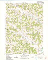
1983 Map of Gillingham
USGS Topo · Published 1983About this map
The Pine River and its numerous tributaries, including Blood River and Fancy Creek, carve through the complex ridge-and-valley landscape of Richland County in the early 1980s. Small rural communities serve as anchors for the surrounding farmsteads, with Bloom City, Woodstock, and Gillingham established at key intersections and stream crossings. The network of roads often follows the natural topography, with named routes like Cribben Hill Road and Marshall Creek Road connecting the high ridges and low valleys.
Find a feature on this map
53 named features on this map. Tap any name to fly to it.
Don’t see what you’re looking for? This feature index may not catch every label — zoom into the map to look around manually.
Map Details
Editions of this 1983 Gillingham Map
This is the sole edition of this map. No revisions or reprints were ever made.
Other maps of this area

1905 · Richland Center
USGS Topo · 1:125,000

1926 · La Farge
USGS Topo · 1:62,500

1927 · Hillsboro
USGS Topo · 1:62,500

1933 · Boaz
USGS Topo · 1:62,500

1958 · La Crosse
USGS Topo · 1:250,000

1960 · Richland Center
USGS Topo · 1:62,500

1961 · La Crosse
USGS Topo · 1:250,000

1965 · La Crosse
USGS Topo · 1:250,000

1965 · La Farge
USGS Topo · 1:62,500

1966 · Hillsboro
USGS Topo · 1:62,500