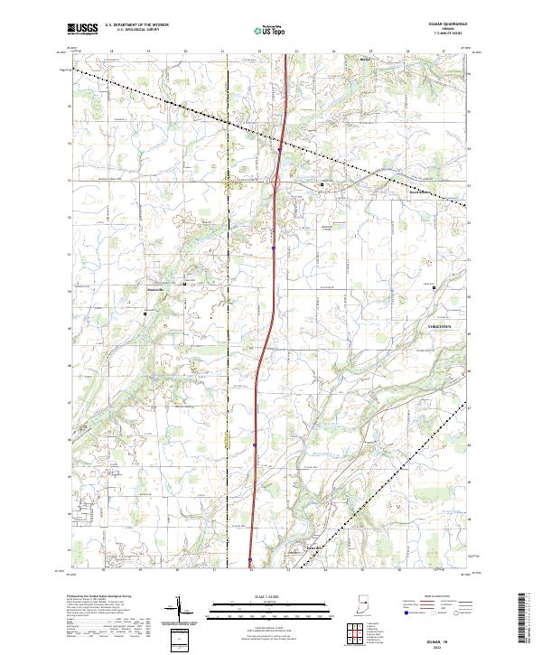
2022 Map of Gilman
USGS Topo · Published 2022About this map
White River and Killbuck Creek drainage systems define this section of the Indiana countryside on the border of Madison and Delaware counties. The landscape transitions from the developed corridors of Yorktown and Daleville in the south toward the smaller rural settlements of Moonville, Bethel, and Reed Station to the north. These communities are linked by an extensive grid of numbered county roads and historic pikes, including the Jackson Street-Pike and Linwood-Moonville Rd.
Find a feature on this map
79 named features on this map. Tap any name to fly to it.
Don’t see what you’re looking for? This feature index may not catch every label — zoom into the map to look around manually.
Map Details
Editions of this 2022 Gilman Map
This is the sole edition of this map. No revisions or reprints were ever made.
Other maps of this area

1952 · Muncie West
USGS Topo · 1:24,000

1952 · Anderson
USGS Topo · 1:24,000

1953 · Muncie
USGS Topo · 1:250,000

1956 · Muncie
USGS Topo · 1:250,000

1960 · Gilman
USGS Topo · 1:24,000

1960 · Middletown
USGS Topo · 1:24,000

1960 · Alexandria
USGS Topo · 1:24,000

1960 · Wheeling
USGS Topo · 1:24,000

1960 · Sulphur Springs
USGS Topo · 1:24,000

1960 · Gaston
USGS Topo · 1:24,000