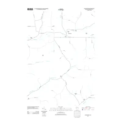
2013 Map of Gilmanton
USGS Topo · Published 2013About this map
Gilmanton stands as a focal point in this 2013 topographic study, situated where the Buffalo River and Elk Cr converge amidst the complex terrain of Buffalo County. The landscape is defined by its deep coulees and valleys, many bearing family names that indicate decades of agricultural settlement. From Bennett Valley in the north to Bohlinger Valley and Leek Valley in the south, the map reveals how local infrastructure like State Road 88 and State Road 121 follows the natural drainage patterns of the Little Waumandee Cr and Pratt Cr. Prominent elevations like Eagle Peak and Tom Mountain overlook a network of rural routes, including Rudy Rd and Hopi Rd, which connect the scattered farms and homesteads of this western Wisconsin region.
Find a feature on this map
52 named features on this map. Tap any name to fly to it.
Don’t see what you’re looking for? This feature index may not catch every label — zoom into the map to look around manually.
Map Details
Editions of this 2013 Gilmanton Map
This is the sole edition of this map. No revisions or reprints were ever made.
Other maps of this area

1929 · Durand
USGS Topo · 1:62,500

1932 · Gilmanton
USGS Topo · 1:62,500

1932 · Durand
USGS Topo · 1:62,500

1932 · Alma
USGS Topo · 1:62,500

1932 · Mondovi
USGS Topo · 1:62,500

1950 · Alma
USGS Topo · 1:62,500

1953 · Eau Claire
USGS Topo · 1:250,000

1958 · Eau Claire
USGS Topo · 1:250,000

1964 · Eau Claire
USGS Topo · 1:250,000
1972 · Tarrant
USGS Topo · 1:24,000