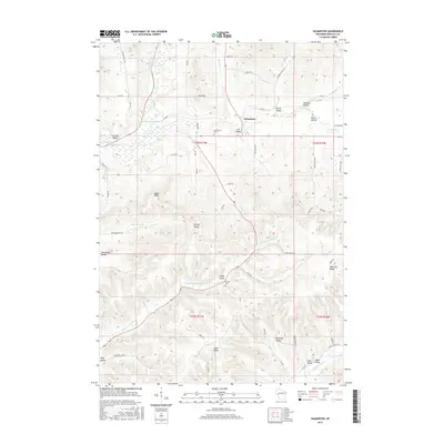
2015 Map of Gilmanton
USGS Topo · Published 2015About this map
Gilmanton serves as the central hub of this Wisconsin landscape, where the Buffalo River and its numerous tributaries have carved a complex system of ridges and coulees. The terrain is defined by its deep valleys, many of which carry the names of early settler families, such as Fisken Valley, Jahns Valley, and Bohlinger Valley. These topographical names reflect a long history of local land use and familial heritage in Buffalo County. Higher elevations are marked by prominent landmarks like Eagle Peak and Tom Mtn, while Montana Ridge borders the southeastern portion of the map. The distribution of Gilmanton Cem and Lincoln Cem near established road networks like Co Rd B and Co Rd U highlights the historical development of these rural communities. The map detail effectively illustrates the drainage patterns of Little Waumandee Cr and Pratt Cr, showing how water dictated the placement of farms and early settlements.
Find a feature on this map
64 named features on this map. Tap any name to fly to it.
Don’t see what you’re looking for? This feature index may not catch every label — zoom into the map to look around manually.
Map Details
Editions of this 2015 Gilmanton Map
This is the sole edition of this map. No revisions or reprints were ever made.
Other maps of this area

1929 · Durand
USGS Topo · 1:62,500

1932 · Gilmanton
USGS Topo · 1:62,500

1932 · Durand
USGS Topo · 1:62,500

1932 · Alma
USGS Topo · 1:62,500

1932 · Mondovi
USGS Topo · 1:62,500

1950 · Alma
USGS Topo · 1:62,500

1953 · Eau Claire
USGS Topo · 1:250,000

1958 · Eau Claire
USGS Topo · 1:250,000

1964 · Eau Claire
USGS Topo · 1:250,000
1972 · Tarrant
USGS Topo · 1:24,000