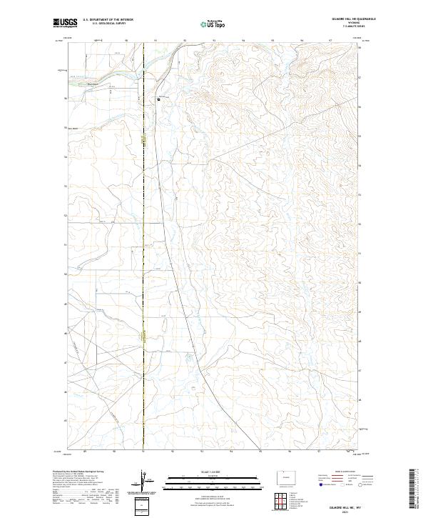
2021 Map of Gilmore Hill NE
USGS Topo · Published 2021About this map
The Jim Bridger Trl cuts across this high-desert landscape on the boundary of Park and Big Horn Counties, tracing a route through a region defined by its sophisticated irrigation network. The northern reaches of the map are anchored by the Shoshone River, which feeds an intricate system of man-made waterways including the Elk Lovell Canal, LN 10 Lateral W, and Lateral W 135. This hydraulic infrastructure transformed the arid terrain into manageable parcels, supporting local life as evidenced by the presence of Penrose Cem near the river bluffs.
Find a feature on this map
25 named features on this map. Tap any name to fly to it.
Don’t see what you’re looking for? This feature index may not catch every label — zoom into the map to look around manually.
Map Details
Editions of this 2021 Gilmore Hill NE Map
This is the sole edition of this map. No revisions or reprints were ever made.
Other maps of this area

1955 · Cody
USGS Topo · 1:250,000

1958 · Cody
USGS Topo · 1:250,000

1962 · Cody
USGS Topo · 1:250,000

1966 · Gilmore Hill NE
USGS Topo · 1:24,000

1966 · Gilmore Hill SE
USGS Topo · 1:24,000

1966 · Garland
USGS Topo · 1:24,000

1966 · Jack Horner Reservoir
USGS Topo · 1:24,000

1966 · Gilmore Hill NW
USGS Topo · 1:24,000

1966 · Gilmore Hill
USGS Topo · 1:24,000
1966 · Lovell
USGS Topo · 1:24,000