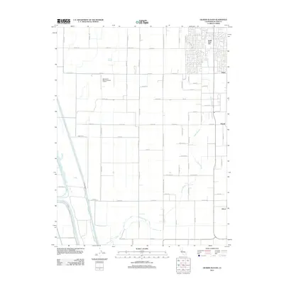
2012 Map of Gilsizer Slough
USGS Topo · Published 2012About this map
The agricultural landscape of Sutter County is defined by its complex water management systems, including the Sutter By-Pass and the Tisdale By-Pass. These large-scale flood control structures dominate the western portion of the area, protecting the fertile lowlands of the Sacramento Valley. The residential expansion of South Yuba City is visible in the northeast, where suburban street grids meet the rural section lines of the surrounding farmland.
Find a feature on this map
52 named features on this map. Tap any name to fly to it.
Don’t see what you’re looking for? This feature index may not catch every label — zoom into the map to look around manually.
Map Details
Editions of this 2012 Gilsizer Slough Map
This is the sole edition of this map. No revisions or reprints were ever made.
Other maps of this area

1888 · Marysville
USGS Topo · 1:125,000

1891 · Marysville
USGS Topo · 1:125,000

1894 · Marysville
USGS Topo · 1:125,000

1895 · Marysville
USGS Topo · 1:125,000

1907 · Dunnigan
USGS Topo · 1:62,500

1910 · Nicolaus
USGS Topo · 1:31,680

1910 · Marcuse
USGS Topo · 1:31,680

1911 · Sutter
USGS Topo · 1:31,680
1911 · Yuba City
USGS Topo · 1:31,680

1911 · Gilsizer Slough
USGS Topo · 1:31,680