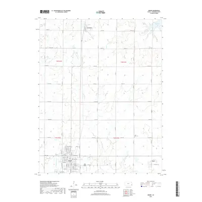
2018 Map of Girard
USGS Topo · Published 2018About this map
The Crawford County seat of Girard serves as the focal point of this 2018 survey, exhibiting a classic Midwestern grid with established neighborhoods bordering the Girard Cem. This region is defined by its watershed network, where Thunderbolt Cr and Second Cow Cr drain the undulating prairie landscape. To the north, the small settlement of Farlington sits near Frisco Lake and the upper reaches of W Fork Dry Wood Cr, while the eastern portion of the map is dominated by the sprawling Bone Creek Reservoir. The landscape is a mixture of agriculture and utility, as evidenced by the local aviation presence at Ziggy Carline Airport and the outlying community of Ringo. Researchers can trace the evolution of local burial grounds and infrastructure, including the rural Union Center Cem situated along the eastern drainage of Clear Cr.
Find a feature on this map
78 named features on this map. Tap any name to fly to it.
Don’t see what you’re looking for? This feature index may not catch every label — zoom into the map to look around manually.
Map Details
Editions of this 2018 Girard Map
This is the sole edition of this map. No revisions or reprints were ever made.
Other maps of this area

1884 · Fort Scott
USGS Topo · 1:125,000

1886 · Joplin
USGS Topo · 1:125,000

1886 · Fort Scott
USGS Topo · 1:125,000

1893 · Fort Scott
USGS Topo · 1:125,000

1894 · Joplin
USGS Topo · 1:125,000

1943 · Cherokee
USGS Topo · 1:62,500

1945 · Pittsburg
USGS Topo · 1:62,500

1945 · Cherokee
USGS Topo · 1:62,500

1947 · Joplin
USGS Topo · 1:250,000

1947 · Pittsburg
USGS Topo · 1:62,500