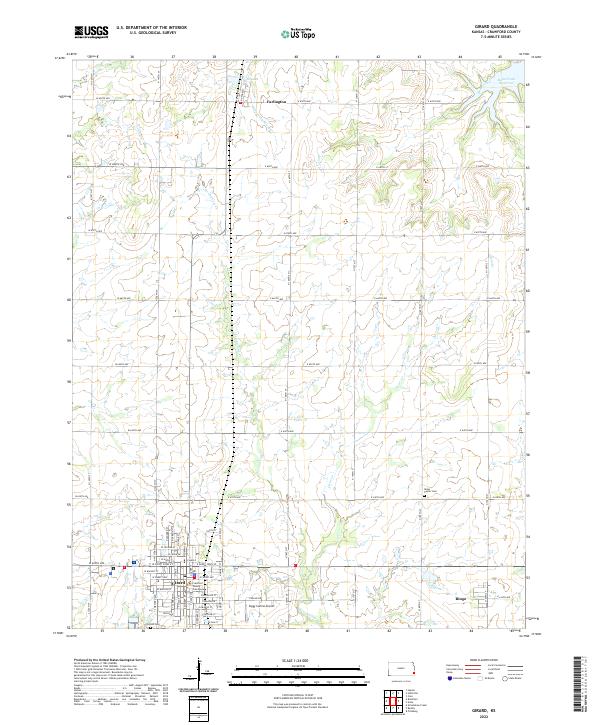
2022 Map of Girard
USGS Topo · Published 2022About this map
Girard serves as the focal point of this Crawford County survey, showing the established grid of the town including the Crawford County Courthouse and Girard Cem. The landscape north of the city is defined by a series of south-flowing waterways, most notably Second Cow Cr and Clear Cr, which carve through the agricultural terrain. To the northeast, the Bone Creek Reservoir forms a significant water body, while smaller features like Enisco Lake and the Ziggy Carline Airport dot the rural outskirts.
Find a feature on this map
77 named features on this map. Tap any name to fly to it.
Don’t see what you’re looking for? This feature index may not catch every label — zoom into the map to look around manually.
Map Details
Editions of this 2022 Girard Map
This is the sole edition of this map. No revisions or reprints were ever made.
Other maps of this area

1884 · Fort Scott
USGS Topo · 1:125,000

1886 · Joplin
USGS Topo · 1:125,000

1886 · Fort Scott
USGS Topo · 1:125,000

1893 · Fort Scott
USGS Topo · 1:125,000

1894 · Joplin
USGS Topo · 1:125,000

1943 · Cherokee
USGS Topo · 1:62,500

1945 · Pittsburg
USGS Topo · 1:62,500

1945 · Cherokee
USGS Topo · 1:62,500

1947 · Joplin
USGS Topo · 1:250,000

1947 · Pittsburg
USGS Topo · 1:62,500