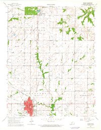
1964 Map of Girard
USGS Topo · Published 1965About this map
Girard serves as the focal point of this mid-1960s Kansas survey, exhibiting a classic Midwestern grid pattern anchored by the county Courthouse and the local Fairground. The town is a notable transportation hub, situated at the intersection of two major rail lines: the Atchison Topeka and Santa Fe and the St Louis-San Francisco. This railway infrastructure suggests the area's historical role in moving agricultural goods and resources through Southeast Kansas.
Find a feature on this map
24 named features on this map. Tap any name to fly to it.
Don’t see what you’re looking for? This feature index may not catch every label — zoom into the map to look around manually.
Map Details
Editions of this 1964 Girard Map
This is the sole edition of this map. No revisions or reprints were ever made.
Other maps of this area

1884 · Fort Scott
USGS Topo · 1:125,000

1886 · Joplin
USGS Topo · 1:125,000

1886 · Fort Scott
USGS Topo · 1:125,000

1893 · Fort Scott
USGS Topo · 1:125,000

1894 · Joplin
USGS Topo · 1:125,000

1943 · Cherokee
USGS Topo · 1:62,500

1945 · Pittsburg
USGS Topo · 1:62,500

1945 · Cherokee
USGS Topo · 1:62,500

1947 · Joplin
USGS Topo · 1:250,000

1947 · Pittsburg
USGS Topo · 1:62,500