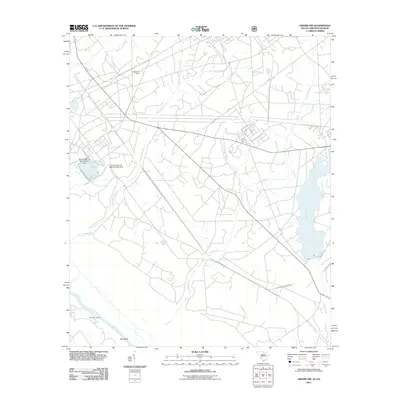
2011 Map of Girard NW
USGS Topo · Published 2011About this map
Chandler Landing and Blue Bluff sit along the northern banks of the Savannah River, marking the southern boundary of this Aiken County landscape. The area is defined by a dense network of drainage systems, including Fourmile Branch, Steel Creek, and Indian Grave Branch, which flow through heavily wooded sections toward the river. Much of the northern terrain is occupied by large-scale infrastructure related to the Savannah River Plant, indicated by restricted roadways like Dunbarton Blvd and specific industrial markers such as the Srp Number 16- 403-D D-3073 Dam. The Cassels Fire Tower stands as a prominent landmark in the north, overseeing the forested tracts between Upper Three Runs and Pen Branch. This 2011 survey documents a specialized landscape where natural riverine features meet modern industrial management.
Find a feature on this map
12 named features on this map. Tap any name to fly to it.
Don’t see what you’re looking for? This feature index may not catch every label — zoom into the map to look around manually.
Map Details
Editions of this 2011 Girard NW Map
This is the sole edition of this map. No revisions or reprints were ever made.
Other maps of this area

1920 · Ellenton
USGS Topo · 1:48,000

1920 · Greens Cut
USGS Topo · 1:62,500

1920 · Talatha
USGS Topo · 1:48,000

1921 · Augusta
USGS Topo · 1:62,500

1921 · Talatha
USGS Topo · 1:62,500

1921 · Ellenton
USGS Topo · 1:62,500

1943 · Greens Cut
USGS Topo · 1:62,500

1943 · Augusta East
USGS Topo · 1:125,000

1943 · Talatha
USGS Topo · 1:62,500

1943 · Augusta
USGS Topo · 1:62,500