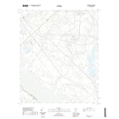
2020 Map of Girard NW
USGS Topo · Published 2020About this map
The Savannah River forms a major geographic boundary along the southwestern edge of this landscape, separating Burke County, Georgia, from Barnwell County, South Carolina. The terrain is defined by a dense network of tributaries including Upper Three Runs, Fourmile Br, and Pen Branch, which snake through the low-lying wetlands toward the river valley. The presence of Atomic Rd and extensive government reservation boundaries indicates a heavily controlled and specialized land use area characteristic of the region's mid-century development. Settlement is sparse, with Blue Bluff appearing as a notable landmark overlooking the river. The map also traces Steel Creek and Indian Grave Br, illustrating the intricate drainage patterns that dominate this part of the Aiken-Barnwell county line.
Find a feature on this map
15 named features on this map. Tap any name to fly to it.
Don’t see what you’re looking for? This feature index may not catch every label — zoom into the map to look around manually.
Map Details
Editions of this 2020 Girard NW Map
This is the sole edition of this map. No revisions or reprints were ever made.
Other maps of this area

1920 · Ellenton
USGS Topo · 1:48,000

1920 · Greens Cut
USGS Topo · 1:62,500

1920 · Talatha
USGS Topo · 1:48,000

1921 · Augusta
USGS Topo · 1:62,500

1921 · Talatha
USGS Topo · 1:62,500

1921 · Ellenton
USGS Topo · 1:62,500

1943 · Greens Cut
USGS Topo · 1:62,500

1943 · Augusta East
USGS Topo · 1:125,000

1943 · Talatha
USGS Topo · 1:62,500

1943 · Augusta
USGS Topo · 1:62,500