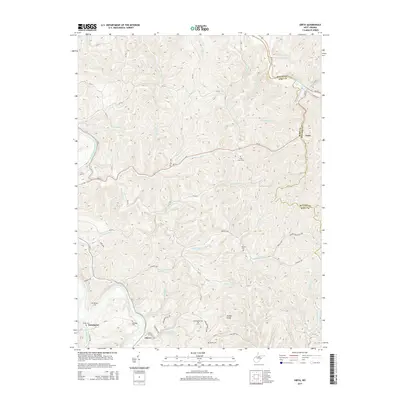
2014 Map of Girta
USGS Topo · Published 2014About this map
The Burning Springs Oil Field serves as a central industrial landmark in this portion of the West Virginia backcountry, highlighting the region's long association with resource extraction. Located near the Little Kanawha River, the area is defined by a dense network of watercourses and winding county roads such as Munday Rd and Bonnett Rd that connect small settlements like Enterprise and Cherry. Genealogists will find a wealth of local landmarks, including the Shiloh Cem, Saratoga Cem, and Morgan Cem tucked into the hillsides. The terrain is notably marked by Ruble Knob and numerous drainages like Standingstone Cr and Wilson Fork, which dictate the placement of rural residences and historical community centers such as Girta.
Find a feature on this map
79 named features on this map. Tap any name to fly to it.
Don’t see what you’re looking for? This feature index may not catch every label — zoom into the map to look around manually.
Map Details
Editions of this 2014 Girta Map
This is the sole edition of this map. No revisions or reprints were ever made.
Other maps of this area

1906 · Elizabeth
USGS Topo · 1:62,500

1907 · Harrisville
USGS Topo · 1:62,500

1907 · Arnoldsburg
USGS Topo · 1:62,500

1907 · Spencer
USGS Topo · 1:62,500

1924 · Harrisville
USGS Topo · 1:62,500

1924 · Elizabeth
USGS Topo · 1:62,500

1925 · Arnoldsburg
USGS Topo · 1:62,500

1926 · Elizabeth
USGS Topo · 1:62,500

1926 · Harrisville
USGS Topo · 1:62,500

1927 · Arnoldsburg
USGS Topo · 1:62,500