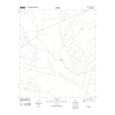
2010 Map of Girvin SE
USGS Topo · Published 2010About this map
Pecos River snakes through the arid landscape of Pecos County, defining the central geography of this West Texas region. In the early 21st century, the area maintained a remote character dominated by ranching and resource extraction, anchored by the Johnson Ranch and the industrial activity of the El Cinco Oil Field. A network of unpaved and rural routes, including Nevill Rd and Rio Pecos Rd, provide the primary access to these isolated properties. To the northeast, the Bobcat Hills rise above the basin, while the historically significant Adobe Crossing marks a point of transit over the river. This survey provides a clear view of the ranching infrastructure and the energy-driven economy that defines this section of the Trans-Pecos, capturing the persistence of large-scale landholdings and petroleum developments.
Find a feature on this map
10 named features on this map. Tap any name to fly to it.
Don’t see what you’re looking for? This feature index may not catch every label — zoom into the map to look around manually.
Map Details
Editions of this 2010 Girvin SE Map
This is the sole edition of this map. No revisions or reprints were ever made.
Other maps of this area

1928 · Crane
USGS Topo · 1:125,000

1929 · Independence Draw Quadrangle
USGS Topo · 1:125,000

1954 · Pecos
USGS Topo · 1:250,000

1954 · Fort Stockton
USGS Topo · 1:250,000

1957 · Pecos
USGS Topo · 1:250,000

1958 · Fort Stockton
USGS Topo · 1:250,000

1969 · Bootleg Canyon
USGS Topo · 1:24,000

1969 · Indian Mesa
USGS Topo · 1:24,000

1969 · Bakersfield
USGS Topo · 1:24,000

1972 · Girvin NE
USGS Topo · 1:24,000