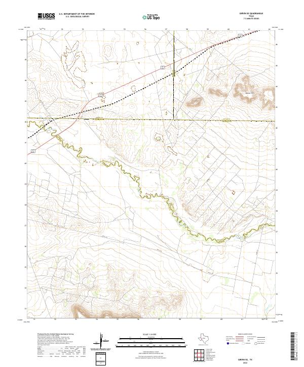
2022 Map of Girvin SE
USGS Topo · Published 2022About this map
The Pecos River carves a winding path through this West Texas landscape, serving as the definitive natural boundary for Pecos and Crockett counties. The terrain is defined by the sharp relief of the Bobcat Hills in the northeast, rising above a network of desert thoroughfares. Local travel is facilitated by a grid of named routes including Nevill Rd, Rio Pecos Rd, and River Rd, which provide access across the arid plains toward the water. To the south, Tunas Cr drains toward the river, illustrating the localized drainage patterns typical of this region. This modern survey from the U.S. Geological Survey documents the intersection of Crane, Upton, Crockett, and Pecos counties, illustrating how geopolitical lines are often tied to the meandering course of the river.
Find a feature on this map
12 named features on this map. Tap any name to fly to it.
Don’t see what you’re looking for? This feature index may not catch every label — zoom into the map to look around manually.
Map Details
Editions of this 2022 Girvin SE Map
This is the sole edition of this map. No revisions or reprints were ever made.
Other maps of this area

1928 · Crane
USGS Topo · 1:125,000

1929 · Independence Draw Quadrangle
USGS Topo · 1:125,000

1954 · Pecos
USGS Topo · 1:250,000

1954 · Fort Stockton
USGS Topo · 1:250,000

1957 · Pecos
USGS Topo · 1:250,000

1958 · Fort Stockton
USGS Topo · 1:250,000

1969 · Bootleg Canyon
USGS Topo · 1:24,000

1969 · Indian Mesa
USGS Topo · 1:24,000

1969 · Bakersfield
USGS Topo · 1:24,000

1972 · Girvin NE
USGS Topo · 1:24,000