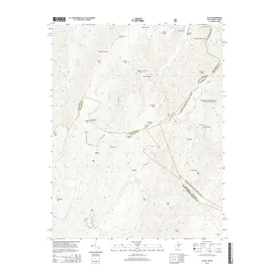
2014 Map of Glace
USGS Topo · Published 2014About this map
Glace and Pedro anchor the mountain valleys of the Allegheny Mountains on this survey, where the borders of West Virginia and Virginia meet along high ridges. The landscape is defined by its watchfulness and isolation, featuring both the Brushy Mountain Lookout Tower and Big Ridge Lookout standing guard over the George Washington National Forest. Evidence of local lineage is found at Dowdy Cem near Grindstone Ridge, while the industrial history of the pass is marked by the Allegheny Tunnel in the northeastern corner. Drainage patterns are complex, with waters like Tuckahoe Run, Cove Cr, and Laurel Cr cutting through named hollows such as Dynamite Hollow and Quarry Hollow. This map traces a transition from forested heights to small valley communities, where landmarks like Cove Creek Spring and the Kates Mountain Overlook provide specific points of interest for researchers and local historians.
Find a feature on this map
62 named features on this map. Tap any name to fly to it.
Don’t see what you’re looking for? This feature index may not catch every label — zoom into the map to look around manually.
Map Details
Editions of this 2014 Glace Map
This is the sole edition of this map. No revisions or reprints were ever made.
Other maps of this area

1887 · Lewisburg
USGS Topo · 1:125,000

1891 · Lewisburg
USGS Topo · 1:125,000

1921 · Callaghan
USGS Topo · 1:48,000

1921 · White Sulphur Springs
USGS Topo · 1:48,000

1921 · Ronceverte
USGS Topo · 1:48,000

1923 · White Sulphur Springs
USGS Topo · 1:62,500

1923 · Ronceverte
USGS Topo · 1:62,500

1923 · Callaghan
USGS Topo · 1:62,500

1935 · White Sulphur Springs
USGS Topo · 1:62,500

1939 · White Sulphur Springs
USGS Topo · 1:62,500