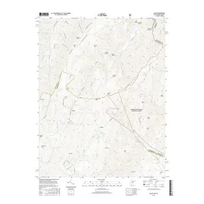
2016 Map of Glace
USGS Topo · Published 2016About this map
Glace and Pedro are the primary settlements in this section of the Allegheny Mountains, situated along the winding border of West Virginia and Virginia. The landscape is defined by high ridges and narrow hollows, with much of the eastern portion preserved within the George Washington National Forest. Evidence of rural community life is seen in the Dowdy Cem and Catholic Cem, while the rugged terrain is marked by descriptive labels like Grindstone Ridge and Dynamite Hollow.
Find a feature on this map
78 named features on this map. Tap any name to fly to it.
Don’t see what you’re looking for? This feature index may not catch every label — zoom into the map to look around manually.
Map Details
Editions of this 2016 Glace Map
This is the sole edition of this map. No revisions or reprints were ever made.
Other maps of this area

1887 · Lewisburg
USGS Topo · 1:125,000

1891 · Lewisburg
USGS Topo · 1:125,000

1921 · Callaghan
USGS Topo · 1:48,000

1921 · White Sulphur Springs
USGS Topo · 1:48,000

1921 · Ronceverte
USGS Topo · 1:48,000

1923 · White Sulphur Springs
USGS Topo · 1:62,500

1923 · Ronceverte
USGS Topo · 1:62,500

1923 · Callaghan
USGS Topo · 1:62,500

1935 · White Sulphur Springs
USGS Topo · 1:62,500

1939 · White Sulphur Springs
USGS Topo · 1:62,500