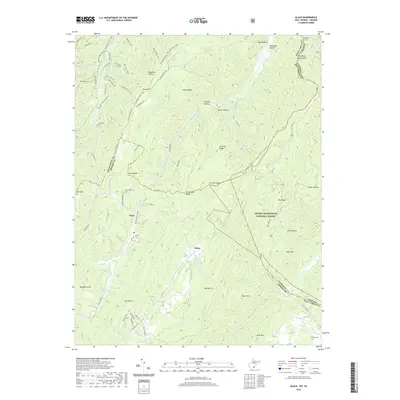
2019 Map of Glace
USGS Topo · Published 2019About this map
Allegheny Mountains ridges define the borderlands between West Virginia and Virginia, creating a landscape of deep hollows and high points like Kates Mtn and Roaring Mtn. The small settlements of Glace and Pedro are situated in the lower elevations, connected by narrow mountain roads such as Hollywood Glace Road and Tuckahoe Road. This area is marked by a complex network of springs and creeks, including Cove Creek Spring and the headwaters of Laurel Creek.
Find a feature on this map
92 named features on this map. Tap any name to fly to it.
Don’t see what you’re looking for? This feature index may not catch every label — zoom into the map to look around manually.
Map Details
Editions of this 2019 Glace Map
This is the sole edition of this map. No revisions or reprints were ever made.
Other maps of this area

1887 · Lewisburg
USGS Topo · 1:125,000

1891 · Lewisburg
USGS Topo · 1:125,000

1921 · Callaghan
USGS Topo · 1:48,000

1921 · White Sulphur Springs
USGS Topo · 1:48,000

1921 · Ronceverte
USGS Topo · 1:48,000

1923 · White Sulphur Springs
USGS Topo · 1:62,500

1923 · Ronceverte
USGS Topo · 1:62,500

1923 · Callaghan
USGS Topo · 1:62,500

1935 · White Sulphur Springs
USGS Topo · 1:62,500

1939 · White Sulphur Springs
USGS Topo · 1:62,500