
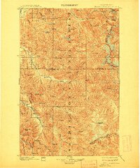
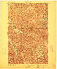
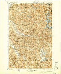
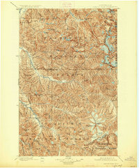
1901 Map of Glacier Peak
USGS Topo · Published 1946About this map
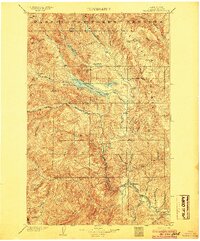
Glacier Peak dominates the southern skyline of this turn-of-the-century survey, a period when the North Cascades were primarily defined by mining prospects and difficult alpine terrain. The settlement at Mineral Park and the small outpost at Gilbert mark the reach of early development along the upper Cascade River, while Bedal sits at the confluence of the North Fork and the South Fork. The topography is densely populated with peaks and ridges that reflects the era's prospecting history, notably seen at Miners Ridge and Horseshoe Basin.
Find a feature on this map
103 named features on this map. Tap any name to fly to it.
Don’t see what you’re looking for? This feature index may not catch every label — zoom into the map to look around manually.
Map Details
Editions of this 1901 Glacier Peak Map
6 editions found
Other maps of this area

1899 · Glacier Peak
USGS Topo · 1:125,000

1899 · Stillaguamish
USGS Topo · 1:125,000

1901 · Glacier Peak
USGS Topo · 1:125,000

1901 · Stilaguamish
USGS Topo · 1:125,000

1901 · Chiwaukum
USGS Topo · 1:125,000

1902 · Skykomish
USGS Topo · 1:125,000

1902 · Stehekin
USGS Topo · 1:125,000

1904 · Stehekin
USGS Topo · 1:125,000
1904 · Chiwaukum
USGS Topo · 1:125,000

1905 · Skykomish
USGS Topo · 1:125,000