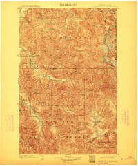
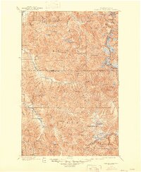
1901 Map of Glacier Peak
USGS Topo · Published 1912About this map
Glacier Peak dominates the southeast corner of this turn-of-the-century topographic survey, where the Cascade Divide separates the Snohomish and Chelan county lines. The landscape is defined by the headwaters of the Sauk River and the Whitechuck River, which carve through the dense terrain of the Washington National Forest and Snoqualmie National Forest. High-altitude features like Horseshoe Basin and Cascade Pass indicate the early charting of mountaineering routes and mineral prospecting zones long before modern road development.
Find a feature on this map
67 named features on this map. Tap any name to fly to it.
Don’t see what you’re looking for? This feature index may not catch every label — zoom into the map to look around manually.
Map Details
Editions of this 1901 Glacier Peak Map
6 editions found
Other maps of this area

1899 · Glacier Peak
USGS Topo · 1:125,000

1899 · Stillaguamish
USGS Topo · 1:125,000

1901 · Glacier Peak
USGS Topo · 1:125,000

1901 · Stilaguamish
USGS Topo · 1:125,000

1901 · Chiwaukum
USGS Topo · 1:125,000

1902 · Skykomish
USGS Topo · 1:125,000

1902 · Stehekin
USGS Topo · 1:125,000

1904 · Stehekin
USGS Topo · 1:125,000

1904 · Chiwaukum
USGS Topo · 1:125,000

1905 · Skykomish
USGS Topo · 1:125,000