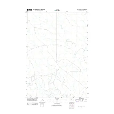
2012 Map of Glad Valley SE
USGS Topo · Published 2012About this map
Thunder Butte Cr meanders across this Ziebach County landscape, carving a network of drainage patterns through the open terrain. This 2012 survey illustrates a sparsely populated section of South Dakota where the topography is defined by the winding course of Beaver Trap Cr and the intermittent flow of smaller tributaries. The limited infrastructure is centered on Thunder Butte Rd and a primary Co Rd, which serve as the essential connectors for the isolated homesteads and ranch lands characteristic of the region. The map captures the quiet, expansive nature of the northern plains, where the relationship between the seasonal watercourses and the sparse road network dictated the movement and settlement patterns of local inhabitants.
Find a feature on this map
4 named features on this map. Tap any name to fly to it.
Don’t see what you’re looking for? This feature index may not catch every label — zoom into the map to look around manually.
Map Details
Editions of this 2012 Glad Valley SE Map
This is the sole edition of this map. No revisions or reprints were ever made.
Other maps of this area

1951 · Redelm NE
USGS Topo · 1:24,000

1951 · Redelm NW
USGS Topo · 1:24,000

1951 · Thunder Butte
USGS Topo · 1:24,000

1953 · McIntosh
USGS Topo · 1:250,000

1958 · McIntosh
USGS Topo · 1:250,000

1982 · Glad Valley
USGS Topo · 1:24,000

1982 · Glad Valley SW
USGS Topo · 1:24,000

1982 · Glad Valley NW
USGS Topo · 1:24,000

1982 · Irish Creek SW
USGS Topo · 1:24,000
1982 · Irish Creek NW
USGS Topo · 1:24,000