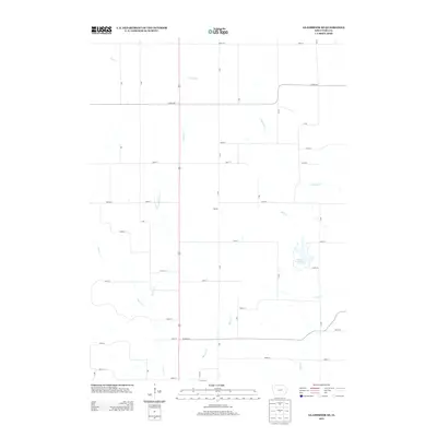
2013 Map of Gladbrook SE
USGS Topo · Published 2013About this map
Otter Creek Lake serves as a prominent focal point in this rural section of Tama County, anchoring the southeastern region with its substantial recreational and environmental footprint. The landscape is defined by an intricate network of waterways, including Salt Cr and its southern branch, S Br Salt Cr, which carve through the agricultural terrain. The small settlement of Homan sits central to a grid of county roads, while other drainages like Jordan Cr and Deer Cr weave through the western parcels. This 2013 survey illustrates the modern layout of rural infrastructure, where secondary routes like Co HWY-e29 and Co HWY-e43 connect isolated farmsteads and local landmarks, providing a clear record of the intersection between Iowa's natural drainage patterns and its long-established township road system.
Find a feature on this map
32 named features on this map. Tap any name to fly to it.
Don’t see what you’re looking for? This feature index may not catch every label — zoom into the map to look around manually.
Map Details
Editions of this 2013 Gladbrook SE Map
This is the sole edition of this map. No revisions or reprints were ever made.
Other maps of this area

1954 · Waterloo
USGS Topo · 1:250,000

1954 · Des Moines
USGS Topo · 1:250,000

1955 · Waterloo
USGS Topo · 1:250,000

1956 · Des Moines
USGS Topo · 1:250,000

1957 · Des Moines
USGS Topo · 1:250,000

1968 · Chelsea
USGS Topo · 1:24,000

1969 · Des Moines
USGS Topo · 1:250,000

1971 · Gladbrook NE
USGS Topo · 1:24,000

1971 · Traer
USGS Topo · 1:24,000
1971 · Clutier
USGS Topo · 1:24,000