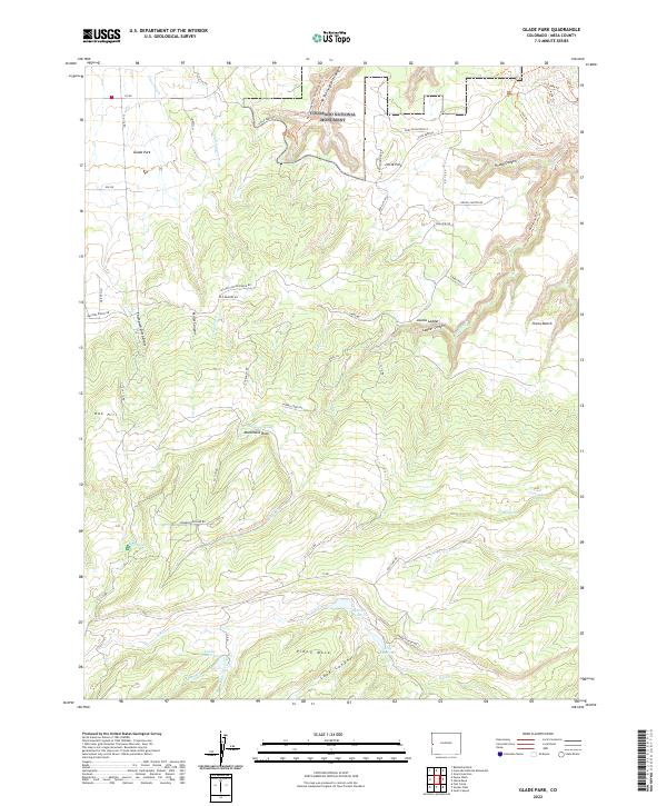
2022 Map of Glade Park
USGS Topo · Published 2022About this map
Colorado National Monument anchors the northern landscape of this Mesa County quadrangle, where the high desert plateau begins its dramatic descent. The settlement of Glade Park and the smaller locality of Little Park serve as central points in a region defined by complex hydrology and ranching infrastructure. Ranch names such as Miller Canyon Ranch Rd, Elk Reserve RD, and Elk Ranch Rd suggest a landscape managed for livestock and wildlife, supported by a network of upland water sources including Schrader Reservoir, King Reservoir, and Gobbo Reservoir. To the south, Piñon Mesa rises above the drainage systems of Moore Cr and Johnson Cr, while prominent geological features like Monument Rock and the steep Jacobs Ladder provide distinctive navigational landmarks. The map also records specialized routes like the Mica Mine Trl, reflecting the area's history of mineral exploration.
Find a feature on this map
62 named features on this map. Tap any name to fly to it.
Don’t see what you’re looking for? This feature index may not catch every label — zoom into the map to look around manually.
Map Details
Editions of this 2022 Glade Park Map
This is the sole edition of this map. No revisions or reprints were ever made.
Other maps of this area

1934 · Colorado National Monument
USGS Topo · 1:24,000

1956 · Moab
USGS Topo · 1:250,000

1956 · Grand Junction
USGS Topo · 1:250,000

1959 · Grand Junction
USGS Topo · 1:250,000

1959 · Moab
USGS Topo · 1:250,000

1960 · Moab
USGS Topo · 1:250,000

1960 · Grand Junction
USGS Topo · 1:250,000

1962 · Moab
USGS Topo · 1:250,000

1962 · Grand Junction
USGS Topo · 1:250,000

1962 · Colorado National Monument
USGS Topo · 1:24,000