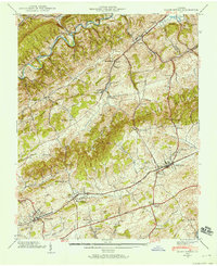
1938 Map of Glade Spring
USGS Topo · Published 1958About this map
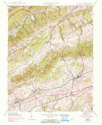
Emory and Henry College stands as a central landmark in this 1938 survey of Washington and Smyth counties, situated just north of the Lee Highway. The landscape is defined by the parallel ridges of Walker Mountain and Rich Ridge, which dictate the path of the Norfolk and Western Railway as it services the established communities of Meadow View and Glade Spring. These rail-dependent settlements developed along the valley floor, while smaller hamlets like Clinchburg and Plasterco occupy the northern gaps near the North Fork Holston River. Numerous family-named burial grounds, including the Snodgrass Cem, Worley Cem, and McNew Cem, are scattered across the slopes, providing a detailed record of local genealogy. Rural life is further mapped through landmarks such as Smyth Chapel and the Morris Sch, illustrating the dispersed community structure of Southwest Virginia prior to the expansion of modern interstates.
Find a feature on this map
57 named features on this map. Tap any name to fly to it.
Don’t see what you’re looking for? This feature index may not catch every label — zoom into the map to look around manually.
Map Details
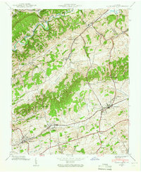
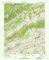
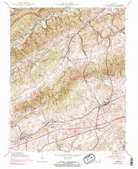
Editions of this 1938 Glade Spring Map
5 editions found
Other maps of this area

1891 · Abingdon
USGS Topo · 1:125,000

1894 · Abingdon
USGS Topo · 1:125,000

1909 · Abingdon
USGS Topo · 1:96,000

1911 · Abingdon
USGS Topo · 1:125,000

1935 · Konnarock
USGS Topo · 1:24,000

1935 · Chilhowie
USGS Topo · 1:24,000

1935 · Maccrady
USGS Topo · 1:24,000

1935 · Abingdon
USGS Topo · 1:24,000

1935 · Mount Rogers
USGS Topo · 1:48,000

1935 · Saltville
USGS Topo · 1:24,000