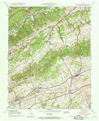
1938 Map of Glade Spring
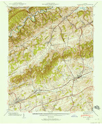
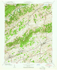
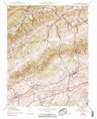
USGS Topo · Published 1970About this map
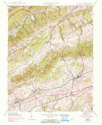
Emory and Henry College stands as a prominent cultural and educational landmark in this southwest Virginia landscape, situated along the Norfolk and Western Railway. The topography is defined by the alternating ridges and valleys characteristic of the region, where Tumbling Mountain and Walker Mountain hem in fertile lowlands like Rich Valley. Small agricultural and industrial settlements including Plasterco, Meadow View, and Glade Spring dot the transport corridors. The map records a dense network of local genealogy, from the Snodgrass Cem and Broady Cem to country congregations at Seven Springs Ch and Smyth Chapel. The intersection of heavy rail and the Lee Highway underscores the area's role as a vital thoroughfare between the mountains, while a dedicated Tramway near Saltville suggests specific industrial or mining activity at the edge of the sheet.
Find a feature on this map
63 named features on this map. Tap any name to fly to it.
Don’t see what you’re looking for? This feature index may not catch every label — zoom into the map to look around manually.
Map Details
Editions of this 1938 Glade Spring Map
5 editions found
Other maps of this area

1891 · Abingdon
USGS Topo · 1:125,000

1894 · Abingdon
USGS Topo · 1:125,000

1909 · Abingdon
USGS Topo · 1:96,000

1911 · Abingdon
USGS Topo · 1:125,000

1935 · Konnarock
USGS Topo · 1:24,000

1935 · Chilhowie
USGS Topo · 1:24,000

1935 · Maccrady
USGS Topo · 1:24,000

1935 · Abingdon
USGS Topo · 1:24,000

1935 · Mount Rogers
USGS Topo · 1:48,000

1935 · Saltville
USGS Topo · 1:24,000