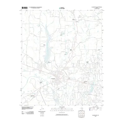
2010 Map of Gladewater
USGS Topo · Published 2010About this map
The Sabine River defines the southern portion of this East Texas survey, winding through a landscape where water management and residential development are closely intertwined. Lake Gladewater dominates the central geography, supported by the Lake Gladewater Dam and surrounded by a network of suburban and rural roads such as Phillips Springs Rd and White Fir Rd. The city of Gladewater serves as the primary hub, while satellite communities like Warren City, Clarksville City, and West Mountain dot the surrounding timberlands and creek basins. Local history is preserved through scattered burial grounds including Edwards Cemetery and Rosedale Cemetery. This 2010 depiction reflects the region's modern infrastructure, from the Gladewater Municipal Airport to the numerous smaller impoundments like Stroman Lake and Wood Lake that characterize the local drainage patterns of Glade Creek and Gum Creek.
Find a feature on this map
83 named features on this map. Tap any name to fly to it.
Don’t see what you’re looking for? This feature index may not catch every label — zoom into the map to look around manually.
Map Details
Editions of this 2010 Gladewater Map
This is the sole edition of this map. No revisions or reprints were ever made.
Other maps of this area

1936 · Kilgore
USGS Topo · 1:48,000

1938 · Winona
USGS Topo · 1:48,000

1940 · Kilgore
USGS Topo · 1:62,500

1943 · Winona
USGS Topo · 1:62,500

1956 · Tyler
USGS Topo · 1:250,000

1960 · Big Sandy
USGS Topo · 1:24,000

1960 · Pritchett
USGS Topo · 1:24,000

1960 · White Oak
USGS Topo · 1:24,000

1960 · Gilmer
USGS Topo · 1:24,000

1960 · Glenwood
USGS Topo · 1:24,000