
1960 Map of Gilmer
USGS Topo · Published 1962About this map
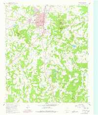
Gilmer serves as the focal point of this East Texas survey, showcasing its mid-century urban development including the Courthouse, City Hall, and several local schools like Ward Sch and Jr High Sch. The town's social life is represented by the Gilmer Country Club, a Drive-in Theater, and a Racetrack located just south of the main settlement. Beyond the town limits, the landscape transitions into a mix of wooded hills and small-scale industry, evidenced by numerous Gravel Pits and the St Louis Southwestern Railroad Grade cutting across the terrain.
Find a feature on this map
39 named features on this map. Tap any name to fly to it.
Don’t see what you’re looking for? This feature index may not catch every label — zoom into the map to look around manually.
Map Details
Editions of this 1960 Gilmer Map
2 editions found
Other maps of this area

1956 · Tyler
USGS Topo · 1:250,000

1960 · Big Sandy
USGS Topo · 1:24,000

1960 · Pritchett
USGS Topo · 1:24,000

1960 · Bettie
USGS Topo · 1:24,000

1960 · White Oak
USGS Topo · 1:24,000

1960 · Thomas
USGS Topo · 1:24,000

1960 · Coffeeville
USGS Topo · 1:24,000

1960 · Glenwood
USGS Topo · 1:24,000

1960 · Gladewater
USGS Topo · 1:24,000

1984 · Tyler
USGS Topo · 1:250,000