
1960 Map of Gladewater
USGS Topo · Published 1962About this map
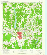
Gladewater serves as the central hub of this East Texas survey, where the convergence of the Sabine River and the Texas and Pacific railroad defined the local economy during the mid-20th century. The map captures a landscape characterized by petroleum infrastructure and local community institutions, featuring numerous oil wells and a Salt Water Disposal Well alongside established neighborhoods. To the north, the substantial Lake Gladewater and smaller bodies like Wood Lake and Honeycutt Lake dominate the drainage basin of Glade Creek.
Find a feature on this map
53 named features on this map. Tap any name to fly to it.
Don’t see what you’re looking for? This feature index may not catch every label — zoom into the map to look around manually.
Map Details
Editions of this 1960 Gladewater Map
2 editions found
Other maps of this area

1936 · Kilgore
USGS Topo · 1:48,000

1938 · Winona
USGS Topo · 1:48,000

1940 · Kilgore
USGS Topo · 1:62,500

1943 · Winona
USGS Topo · 1:62,500

1956 · Tyler
USGS Topo · 1:250,000

1960 · Big Sandy
USGS Topo · 1:24,000

1960 · Pritchett
USGS Topo · 1:24,000

1960 · White Oak
USGS Topo · 1:24,000

1960 · Gilmer
USGS Topo · 1:24,000

1960 · Glenwood
USGS Topo · 1:24,000