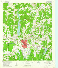
1960 Map of Gladewater
USGS Topo · Published 1962About this map
Lake Gladewater dominates the northern landscape of this East Texas terrain, its branching fingers reaching into the surrounding piney woods north of Gladewater. By the early 1960s, the region shows a dense network of energy infrastructure, evidenced by numerous oil wells and a Salt Water Disposal Well scattered across the Gladewater City Boundary and into Clarksville City. The southern edge of the survey is defined by the winding course of the Sabine River, which separates the industrial and municipal growth of the city from the more rural wetlands to the south.
Find a feature on this map
41 named features on this map. Tap any name to fly to it.
Don’t see what you’re looking for? This feature index may not catch every label — zoom into the map to look around manually.
Map Details
Editions of this 1960 Gladewater Map
2 editions found

Other maps of this area

1936 · Kilgore
USGS Topo · 1:48,000

1938 · Winona
USGS Topo · 1:48,000

1940 · Kilgore
USGS Topo · 1:62,500

1943 · Winona
USGS Topo · 1:62,500

1956 · Tyler
USGS Topo · 1:250,000

1960 · Big Sandy
USGS Topo · 1:24,000

1960 · Pritchett
USGS Topo · 1:24,000

1960 · White Oak
USGS Topo · 1:24,000

1960 · Gilmer
USGS Topo · 1:24,000

1960 · Glenwood
USGS Topo · 1:24,000