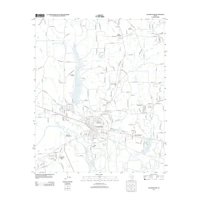
2013 Map of Gladewater
USGS Topo · Published 2013About this map
The city of Gladewater serves as the central hub of this East Texas region, situated along the Sabine River. The landscape is defined by its water resources, featuring Lake Gladewater and Lake Devernia, alongside numerous smaller bodies like Stroman Lake and Honeycutt Lake. The area's topography is marked by several named rises, including West Mountain and East Mountain. This survey documents a developed transportation and industrial network, including the Gladewater Municipal Airport and several smaller incorporated areas such as Clarksville City, Warren City, and Union Grove. Genealogists may find interest in the documented burial sites, such as Rosedale Cem and Edwards Cem, which sit among a complex web of Farm to Market roads like FM-1404 and FM-2685.
Find a feature on this map
191 named features on this map. Tap any name to fly to it.
Don’t see what you’re looking for? This feature index may not catch every label — zoom into the map to look around manually.
Map Details
Editions of this 2013 Gladewater Map
This is the sole edition of this map. No revisions or reprints were ever made.
Other maps of this area

1936 · Kilgore
USGS Topo · 1:48,000

1938 · Winona
USGS Topo · 1:48,000

1940 · Kilgore
USGS Topo · 1:62,500

1943 · Winona
USGS Topo · 1:62,500

1956 · Tyler
USGS Topo · 1:250,000

1960 · Big Sandy
USGS Topo · 1:24,000

1960 · Pritchett
USGS Topo · 1:24,000

1960 · White Oak
USGS Topo · 1:24,000

1960 · Gilmer
USGS Topo · 1:24,000

1960 · Glenwood
USGS Topo · 1:24,000