Loading...
Loading map...2022 Map of Gladewater
USGS Topo · Published 2022About this map
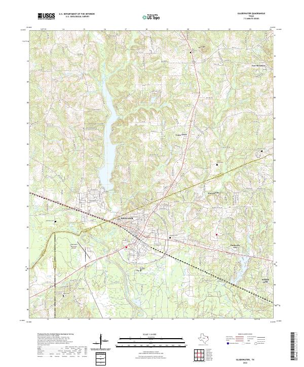
Gladewater serves as the central hub of this East Texas survey, where the convergence of the Sabine River and a dense network of tributaries like Glade Br and Mitchell Br define the local topography. The landscape is characterized by a series of small, incorporated communities including Warren City, Clarksville City, and Union Grove, each situated along significant transport corridors such as the Old Longview Hwy and S Loop 485.
Find a feature on this map
62 named features on this map. Tap any name to fly to it.
Don’t see what you’re looking for? This feature index may not catch every label — zoom into the map to look around manually.
Map Details
Date Portrayed2022
Date Published2022
PublisherU.S. Geological Survey
Map TypeTopographic
Scale1:24000
Physical Dimensions24 x 29 inches
Editions of this 2022 Gladewater Map
This is the sole edition of this map. No revisions or reprints were ever made.
Historical Maps of Phillips Through Time
Featured Locations
Source Details
SourceU.S. Geological Survey
CopyrightPublic Domain