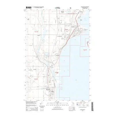
2014 Map of Gladstone
USGS Topo · Published 2014About this map
Escanaba River drainage and the western shores of Lake Michigan define this coastal landscape in Delta County. The urban and industrial corridor between Escanaba and Gladstone is well-established, showing the dense street grids and rail infrastructure of the Soo Line. Educational and transportation hubs are prominent, with the Bay de Noc Community College campus situated near North Escanaba and the West Gladstone Airport serving the northern reaches. The transition from industrial settlements like Wells and Groos to the protected woodlands of the Hiawatha National Forest is clear, while several local burial grounds including Fernwood Cem and Garden of Rest Cem provide essential data for genealogical research in these lakeside communities.
Find a feature on this map
67 named features on this map. Tap any name to fly to it.
Don’t see what you’re looking for? This feature index may not catch every label — zoom into the map to look around manually.
Map Details
Editions of this 2014 Gladstone Map
This is the sole edition of this map. No revisions or reprints were ever made.
Other maps of this area

1932 · Gladstone NE
USGS Topo · 1:31,680

1932 · Gladstone SE
USGS Topo · 1:31,680

1932 · Rapid River NW
USGS Topo · 1:31,680

1932 · Rapid River SW
USGS Topo · 1:31,680

1932 · Gladstone SW
USGS Topo · 1:31,680

1932 · Gladstone NW
USGS Topo · 1:31,680

1950 · Gladstone NW
USGS Topo · 1:31,680

1954 · Escanaba
USGS Topo · 1:250,000

1957 · Escanaba
USGS Topo · 1:250,000

1958 · Escanaba
USGS Topo · 1:250,000